



Muchu Chhish is a 7,453 m peak in the Batura Muztagh, the westernmost sub-range of the Karakoram, above the Batura Glacier in Gojal, Upper Hunza. For years it was the highest unclimbed mountain on earth that was actually open to climbers, until a three-man Czech team stood on top on 5 July 2024 after a six-day climb without bottled oxygen. It is approached from Passu on the Karakoram Highway, climbed in the June to August window, and it is a serious, technical, expedition-grade objective — not a trekking peak.
We run in Gilgit-Baltistan with our own team, and we will be straight with you about this one. Muchu Chhish is not a mountain you book because you liked a photograph. It went unclimbed for decades not because nobody noticed it, but because the north side is barred by icefall and the only sensible line borrows a neighbour’s ridge. Most people reading this page will get more out of standing under the Batura Wall than on it — and that is a fine trip in its own right. But if you are a climbing team looking for a real Karakoram objective with almost no traffic on it, here is the honest picture.
Key Takeaways
- Height: 7,453 m (24,452 ft), Batura Muztagh, Karakoram.
- Where: Above the Batura Glacier, Gojal / Upper Hunza, Gilgit-Baltistan, Pakistan.
- Prominence: only 263 m above the nearest col — it is a giant, but a subsidiary one.
- First ascent: 5 July 2024 by Zdeněk Hák, Radoslav Groh and Jaroslav Bánský (Czech Republic), six days, no supplementary oxygen.
- Normal line: there isn’t one. Teams use the South Ridge of neighbouring Batura VI (7,462 m); the north side is effectively barred by icefall.
- Season: June to August. It needs a mountaineering permit, not a trekking one.
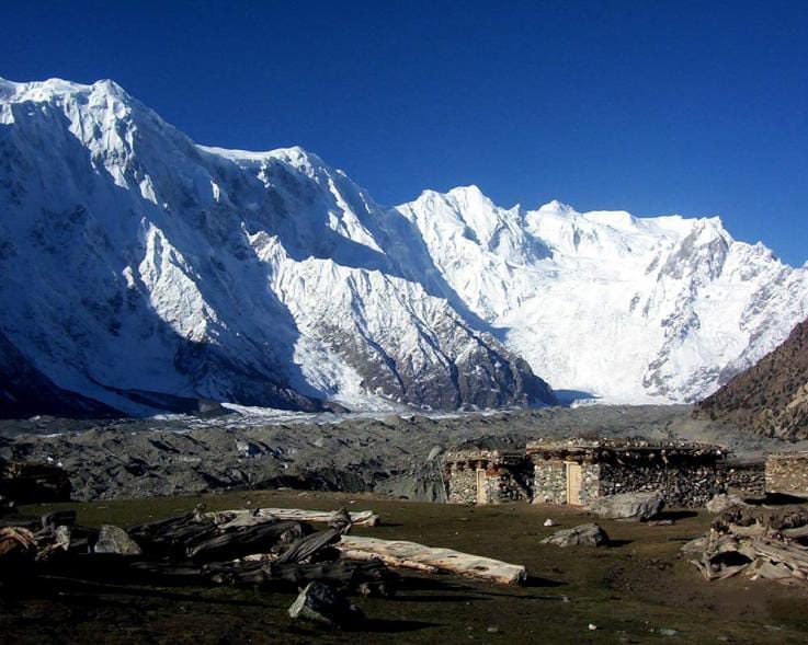
Where Muchu Chhish is, and why it stayed unclimbed
The Batura Muztagh is the western end of the Karakoram, running from Chalt in the Bar valley across to Kampir Dior in the Kurumbar. Its high ground is a single long wall of seven-thousanders above the Batura Glacier, one of the longest glaciers outside the polar regions. Batura Sar at 7,795 m is the high point of the range. Muchu Chhish sits along that same wall, and the glacier flanks it to the north.
Two things kept it off summit lists. First, the geography: Muchu Chhish has no well-defined ridge of its own to the north or south, and the northern approach is close to impassable because of glacial icefall. Teams therefore have to climb the South Ridge of Batura VI (7,462 m), the peak immediately to the west, and traverse. Second, the paperwork and the remoteness: this is a corner of Gojal with no trade route to it, no lodges, no rescue infrastructure of its own, and a long way from anything.
The prominence figure tells the story bluntly. Muchu Chhish rises only 263 m above its connecting col. By the strict rules used for lists of independent mountains it barely qualifies as its own peak — which is exactly why it survived so long as “the highest unclimbed summit open to climbers” while genuinely independent giants nearby were ticked off decades ago.
The route, step by step
There is no trade route on this mountain. What follows is the shape of an expedition as the successful and near-successful attempts have run it — not a fixed itinerary, because the day count depends on your team, the snow and the weather window.
- Islamabad to Gilgit or Hunza. Fly, or drive the Karakoram Highway. Build in buffer days either way; mountain flights cancel.
- Up the KKH to Passu, Gojal. Passu is the roadhead for the Batura. Last shop, last reliable phone signal, last comfortable bed.
- Walk in along the Batura Glacier. The approach follows the glacier valley west, with porters, to a base camp under the southern flank of the Batura wall.
- Acclimatisation rotations. Non-negotiable at this altitude. See our acclimatisation guide for how we structure this.
- The South Ridge of Batura VI. The line to the main ridge. Polish climbers first took it in 1983, using fixed ropes, on the first ascent of Batura V and VI.
- Traverse west along the main ridge to the summit. Corniced, exposed, and the reason teams turned back so many times.
- Down, and out to Passu. Descent on a corniced ridge after a multi-day push is the most dangerous part of the trip. Plan the reserve for it.
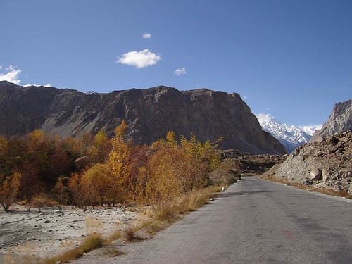
The history: four decades of turning back
The record here is short, and every line in it is a retreat until the last one.
- 1983 — A Polish expedition climbs the South Ridge of Batura VI with fixed ropes, making the first ascents of Batura V (7,531 m) and Batura VI (7,462 m). Muchu Chhish is left alone.
- 1999 — A Spanish team reaches 6,650 m on the south ridge and stops there.
- 2020 — A three-man Czech expedition including Pavel Kořínek and Pavel Bém is shut down by weather.
- 2021 — The same climbers return; too much snow on the ridge.
- 2023 — A Czech attempt turns around roughly 250 m below the summit.
- 5 July 2024 — Zdeněk Hák, Radoslav Groh and Jaroslav Bánský reach the top at 10:20 in the morning, six days up, no bottled oxygen. The highest unclimbed peak in the Karakoram is finally climbed.
Read that list again before you plan anything. Two hundred and fifty metres short, after weeks of work, by a Piolet d’Or winner. That is the standard this mountain sets.
When to go
| Months | Conditions | Verdict |
|---|---|---|
| March–May | Deep winter snow still on the ridge; unstable, cold, short usable spells. | No. |
| June | Season opening. Glacier travel improving, ridge often still heavily loaded. | Possible — good for acclimatisation and stocking camps. |
| July | The prime window. The 2024 first ascent summited on 5 July. | Best. |
| August | Warm, more melt-out and rockfall low down, weather still workable. | Good. |
| September onward | Cold returns fast, days shorten, storms arrive. | Closing. |
For the wider picture across the region, see our season-by-season guide to Gilgit-Baltistan.
How hard is it, honestly
Hard enough that it took forty years and repeated attempts by very strong alpinists. This is a technical, alpine-style objective on a corniced high ridge at over 7,400 m, with no fixed infrastructure, no other teams on the mountain to break trail or help in a bad hour, and a descent that is as committing as the climb.
What we look for in a team: previous 7,000 m experience, solid rope work, self-rescue and crevasse rescue competence, real cold tolerance, and the discipline to turn around. Fitness matters, but judgement matters more. If you have not yet been to 7,000 m, go and do Shispare Sar, Passu Sar or Bojohagur Duanasir I first — and if you want to see this country without climbing, the Shimshal Pass trek is the trip we would send you on.
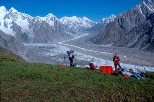
Safety: the real risk here
The named dangers on Muchu Chhish are cornice collapse on the summit ridge, avalanche loading after storm, crevasse hazard on the Batura approach, and the plain fact that you are days from a road with no other expeditions nearby. There is no rescue that arrives by itself. We carry a satellite phone in camp, we work with established helicopter-rescue contacts for Gilgit-Baltistan, we require evacuation-capable insurance before departure, and we plan the turnaround before the summit day, not during it. If a budget quote does not name these things, it has cut them.
Permits and access
Muchu Chhish is a climbing objective, not an open-zone trek, so it requires a mountaineering permit through Pakistan’s Alpine Club and Ministry of Tourism, a liaison officer, and lead time — months, not weeks. You will also need the correct visa: a Trekking and Mountaineering visa, which is not the standard tourist visa. Start with our Pakistan visa guide for trekkers, and make sure your insurance actually covers high-altitude climbing and helicopter evacuation. We handle the permit paperwork; you handle the visa and the insurance.
Getting there and what it costs
Islamabad to Gilgit by air, or the long way up the Karakoram Highway, then north through Hunza to Passu in Gojal. From Passu it is glacier and porters.
We keep pricing personal rather than posting a number that goes stale the week the permit fees or porter rates move. Tell us your team size, your dates and what you want carried, and we will build the costing line by line so you can see exactly what you are paying for. Fair price, no corners cut — and we will tell you plainly if we think the objective is wrong for your team rather than take the booking.
Frequently asked questions
How high is Muchu Chhish?
7,453 m (24,452 ft). It stands in the Batura Muztagh sub-range of the Karakoram, above the Batura Glacier in Gojal, Upper Hunza, Gilgit-Baltistan.
Has Muchu Chhish been climbed?
Yes. It was first climbed on 5 July 2024 by the Czech team of Zdeněk Hák, Radoslav Groh and Jaroslav Bánský, after a six-day ascent without bottled oxygen. Before that it was the highest unclimbed peak in the Karakoram and the highest unclimbed mountain open to climbers.
Why was it unclimbed for so long?
The north side is nearly impassable because of glacial icefall, and the peak has no well-defined ridge of its own, so teams must climb the South Ridge of neighbouring Batura VI (7,462 m) and traverse. Add remoteness, permits and weather, and attempts in 1999, 2020, 2021 and 2023 all turned back — the 2023 attempt just 250 m below the top.
Do I need a permit to climb Muchu Chhish?
Yes. It requires a mountaineering permit and a liaison officer, arranged months in advance, plus a Pakistan Trekking and Mountaineering visa rather than a tourist visa. Insurance covering high-altitude climbing and helicopter evacuation is required.
What is the best time to attempt it?
June to August, with July the prime window — the first ascent summited on 5 July. Earlier in the year the ridge is heavily snow-loaded; from September the weather closes in.
Talk to the people who live here
We are a local Balti team based in Skardu, not a broker who passes you to someone else once you have paid. Our guides, our logistics, our sat phone, our rescue plan.
WhatsApp: +92 312 9921574 · Email: info@karakoramventure.com
Send us your team, your dates and your climbing history, and we will tell you honestly whether Muchu Chhish is the right objective for you.
Sources & attribution: elevation, prominence, route and first-ascent details from Wikipedia (Muchu Chhish; Batura Muztagh), Peakbagger, the American Alpine Club publications and Explorersweb reporting on the 2024 first ascent. Images: Batura valley above Passu and view into the Batura valley — Sultanalipassu, CC BY-SA 3.0, via Wikimedia Commons; Batura Glacier — Aazur, public domain, via Wikimedia Commons. Figures are approximate where sources differ.

