



Yutmaru Sar is a 7,283 m (23,894 ft) peak in the Hispar Muztagh, the sub-range of the Karakoram that rises north of the Hispar Glacier in Nagar District, Gilgit-Baltistan, Pakistan. It sits west of Kanjut Sar, and it was first climbed on 22 July 1980 by a Japanese expedition that reached the upper Yutmaru Glacier and then took the west ridge. The climbing season is June to August. We plan it as a 40–45 day expedition door to door, and it is a remote, self-reliant objective — not a first seven-thousander.
We run this out of Skardu and Gilgit with our own Balti and Hunza-Nagar staff, and we will be straight with you: almost nobody goes to Yutmaru Sar. It is the quiet one on a skyline full of louder mountains — Distaghil Sar, Khunyang Chhish, Kanjut Sar all pull the attention and the expeditions. What that means in practice is no fixed ropes left by somebody else, no second team on the glacier, and no quick way out. If that is what you came for, we will build the logistics around it properly. If it is not, we will tell you so and point you at a better first mountain.
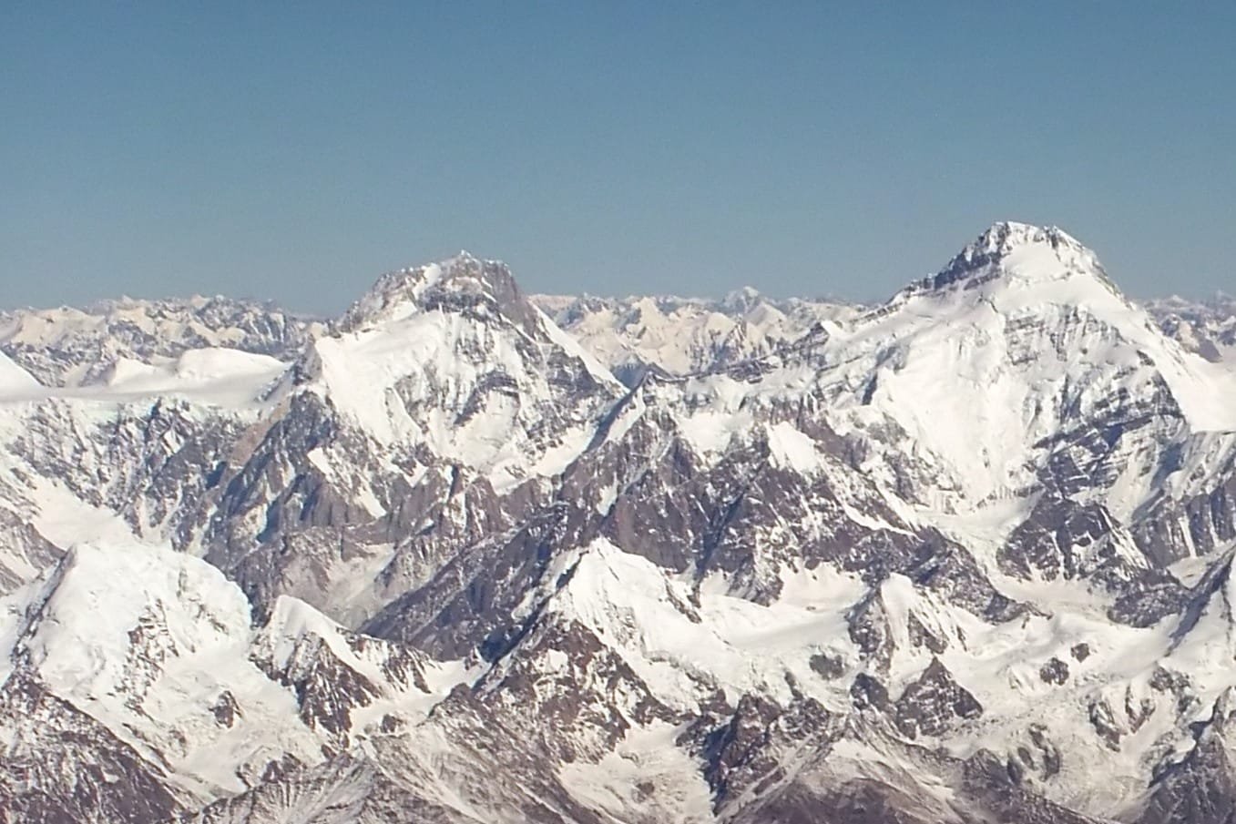
Key Takeaways
- Height: 7,283 m (23,894 ft) — ranked around the 87th–88th highest mountain on earth, depending on the list you read.
- Where: Hispar Muztagh, north of the Hispar Glacier and west of Kanjut Sar, Nagar District, Gilgit-Baltistan.
- Prominence: about 620 m, with Yukshin Gardan Sar (7,530 m) as its parent peak — it is a high shoulder of a bigger massif, not a free-standing giant.
- First ascent: 22 July 1980, a Japanese expedition, via the upper Yutmaru Glacier and the west ridge.
- Season: June to August. Our planning window is 40–45 days door to door.
- Approach: Gilgit → Nagar → Hispar village, then on foot up the Hispar Glacier and into the Yutmaru Glacier.
Where Yutmaru Sar is, and why it gets overlooked
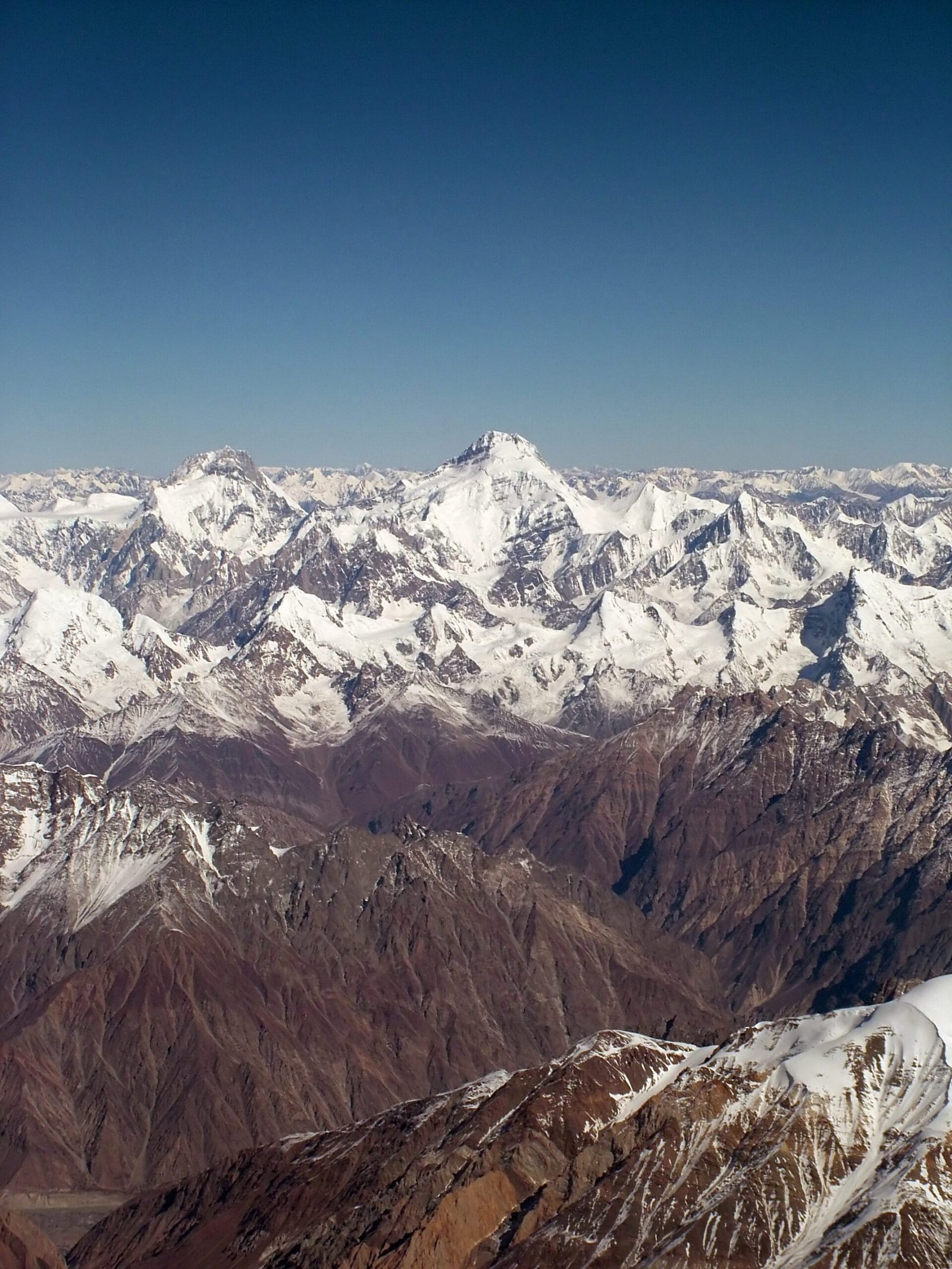
The Hispar Muztagh is a wall of seven-thousanders standing between the Hispar valley and Shimshal. Line them up by height and Yutmaru Sar sits well down its own range — below Malubiting and Momhil Sar, and below Distaghil Sar (7,885 m), Khunyang Chhish (7,852 m), Kanjut Sar (7,760 m), Trivor, Yukshin Gardan Sar and Pumari Chhish. That is the whole story of its obscurity. In any other range a 7,283 m summit would be the headline. Here it is a name on a ridge behind bigger names.
Its low prominence — around 620 m — tells you the same thing in numbers. Yutmaru Sar rises off the same massif as Yukshin Gardan Sar rather than standing alone above a glacier basin. Climbers chasing independent summits skip it. Climbers who want a genuinely quiet high peak with a real approach walk should not.
Schematic comparison, approximate. Yutmaru Sar in orange.
The route: how an expedition actually runs
This is the shape of it, not a promise of dates. Weather on the Hispar decides the calendar, and we would rather build a buffer in than sell you a schedule the mountain will not honour.
- Islamabad to Gilgit. By air when the weather holds, by the Karakoram Highway when it does not. We plan for both — see our Karakoram Highway guide.
- Gilgit to Nagar and Hispar village. Jeep road up the Hispar valley to the last village, around 3,200 m. This is where porters are hired and the expedition properly begins.
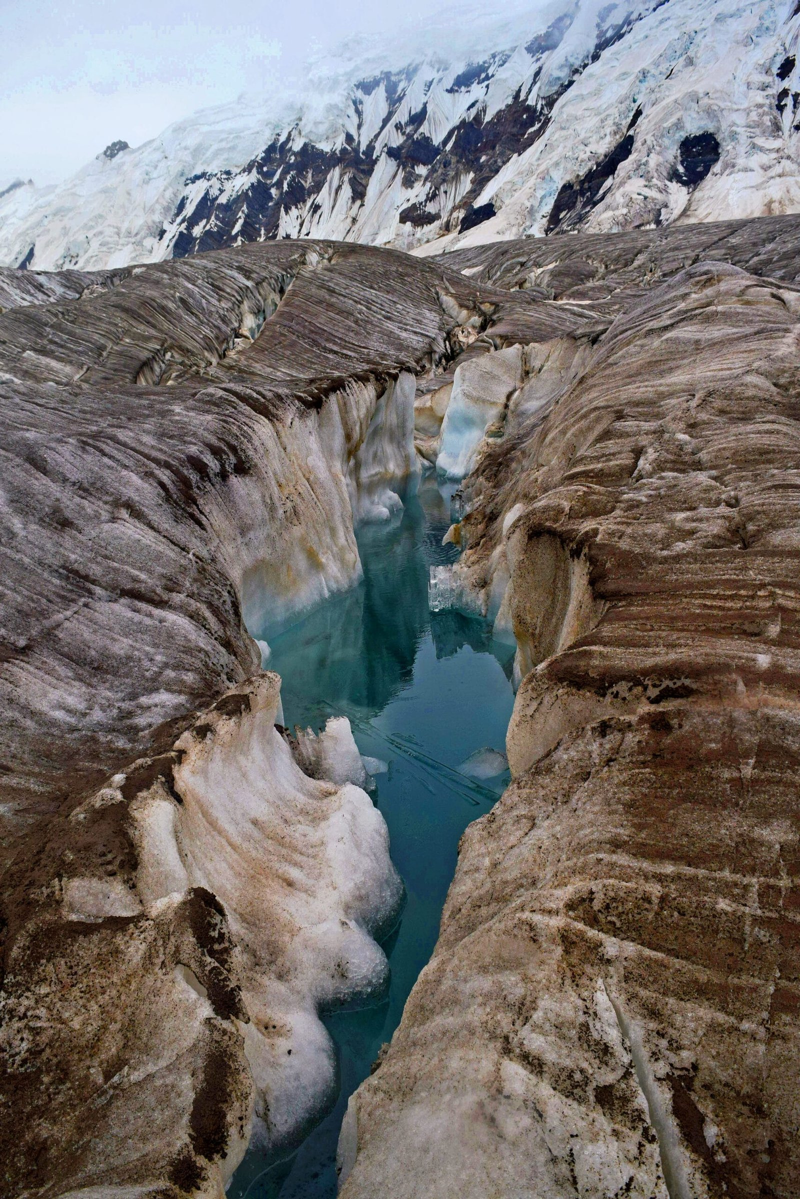
- Onto the Hispar Glacier. A multi-day walk east along 49 km of ice — the same corridor that carries the Snow Lake and Hispar La traverse. Ablation valleys, meltwater channels, and moraine that eats boots.
- Into the Yutmaru Glacier. Turning north off the Hispar into the side glacier that gives the mountain its name, and establishing base camp on it. We fix the exact site on the ground each year rather than printing an altitude that the ice will move.
- Acclimatisation and load-carrying. Rotations up the glacier basin to place the higher camps. Read our acclimatisation guide before you come; people lose expeditions here, not on the summit ridge.
- The west ridge. The 1980 Japanese line: gain the col on the west ridge, camp high on it, and follow the ridge to the summit.
- Descent and walk out. Back down the Yutmaru and the Hispar to Hispar village. Budget spare days. The glacier in late August is not the glacier you walked in on.
The 1980 first ascent, and the silence since
Yutmaru Sar was climbed for the first time on 22 July 1980 by a Japanese expedition. They worked their way onto the upper Yutmaru Glacier, gained the col on the west ridge in early July, placed a high camp at around 6,150 m, and followed the ridge to the top later that month. The summit party is recorded as T. Sugimoto, M. Watanabe and M. Motegi.
What is striking is what did not happen afterwards. Forty-plus years on, Yutmaru Sar has almost no traffic. Records of repeat ascents are thin, and the mountain does not appear in the commercial circuit at all. We will not claim a precise number of ascents because the record is genuinely incomplete — but if you stand on that summit you will be part of a very short list.
The profile: from the Karakoram Highway to 7,283 m
Schematic profile, approximate. Only the summit height and the recorded 1980 high camp are fixed figures; everything between moves with the ice.
When to go
| Months | Conditions | Verdict |
|---|---|---|
| October–April | Snowbound. Hispar valley effectively closed to expeditions. | Closed |
| May | Deep snow low down, cold and unsettled, porters reluctant. | Too early |
| June | Glacier still well bridged, cold nights, weather changeable. | Good for approach and rotations |
| July | The most settled spell. Meltwater streams run hard by afternoon. | Best summit window |
| August | Still climbable. Crevasses opening, glacier travel slower. | Workable, more objective hazard |
| September | Cold returns, days shorten, staff heading down for harvest. | Late — walk-outs only |
If you want the wider picture across Gilgit-Baltistan, our best time to visit guide covers the whole region season by season.
How hard is it, honestly
Hard, and hard in a way that has little to do with the summit day. Three things make Yutmaru Sar serious:
The approach
Forty-nine kilometres of the Hispar Glacier, on foot, with an expedition’s worth of loads behind you. Moraine, ablation valleys, meltwater channels that are ankle-deep at dawn and impassable by four in the afternoon. Nothing technical. Just long, and it will find any weakness in your feet, your boots or your patience.
The altitude
7,283 m with no supplementary oxygen, on a mountain where you carry your own rotations. You need a genuine 6,000 m summit behind you, ideally a 7,000 m one. If this would be your first seven-thousander, go to Spantik first — we would rather sell you the right mountain than the one you asked for.
The isolation
There is no other team on the Yutmaru Glacier to help you. Self-rescue is the working assumption. That shapes everything: the team size, the medical kit, the communications, and how conservative we are about turning around.
Safety: the real risk here is the walk out, not the summit
On a mountain this remote, an injury on the glacier at day nineteen is a bigger problem than bad weather at 7,000 m. Helicopter evacuation in the Hispar is weather-dependent and slow, and it is not something you improvise. Every Karakoram Venture expedition carries a satellite phone in base camp, we hold established helicopter-rescue contacts for the region, and we require you to arrive with proper high-altitude rescue and repatriation cover — see our insurance guide for high-altitude trekking in Pakistan. We will turn a team around rather than stretch the plan. That is the deal, and we say it plainly because it is where budget operators cut.
Permits and visa
Yutmaru Sar is above 6,500 m, so this is mountaineering, not open-zone trekking: it requires a formal mountaineering permit through the Pakistani authorities, and expeditions on peaks of this height are normally assigned a liaison officer. That is an application process with lead time, and we handle it — but you need to come to us early, not six weeks out. Separately, you must enter Pakistan on a Trekking & Mountaineering visa, not an ordinary tourist visa. Our Pakistan visa guide for trekkers walks through it.
Getting there, and what it costs
Islamabad to Gilgit by air is fast and weather-dependent; the Karakoram Highway is longer and always works. For an expedition of this length we usually plan to fly and keep road days in reserve, because losing three days at the front end to a cancelled flight is the kind of thing that quietly eats a summit window. From Gilgit it is jeep road up through Nagar to Hispar village, and then everything is on foot.
On price: we keep pricing personal rather than posting a number that goes stale. An expedition like this is costed around your team size, the permit and liaison officer, porter loads for the Hispar walk-in, and how many spare days you want built in. What we will commit to is the principle — a fair price, and no corners cut on guides, food, or the safety kit. Message us with your dates and team size and you will get a real figure, not a brochure range.
Frequently asked questions
How high is Yutmaru Sar?
Yutmaru Sar is 7,283 m (23,894 ft), which places it around the 87th to 88th highest mountain on earth depending on which list you use. It has a prominence of about 620 m, with Yukshin Gardan Sar (7,530 m) as its parent peak.
Where is Yutmaru Sar?
In the Hispar Muztagh sub-range of the Karakoram, north of the Hispar Glacier and west of Kanjut Sar, in Nagar District, Gilgit-Baltistan, Pakistan. Access is from Gilgit through the Nagar valley to Hispar village, then on foot up the Hispar Glacier.
Who made the first ascent of Yutmaru Sar?
A Japanese expedition made the first ascent on 22 July 1980, approaching by the upper Yutmaru Glacier and climbing the west ridge. The summit party is recorded as T. Sugimoto, M. Watanabe and M. Motegi.
When is the climbing season on Yutmaru Sar?
June to August, with July usually the most settled window. We plan expeditions on a 40 to 45 day door-to-door schedule so there are spare days for weather and for the long glacier approach.
Do I need a permit and a special visa?
Yes to both. A peak of this height requires a mountaineering permit and normally a liaison officer, and you must enter Pakistan on a Trekking and Mountaineering visa rather than a standard tourist visa. Both need lead time, so contact us early.
Talk to the team that actually walks the Hispar
We are a local Balti and Hunza-Nagar outfit based in Skardu, not a broker who hands you to somebody else at the airport. Same guides, same cooks, same high-altitude porters, year after year.
WhatsApp: +92 312 9921574 · Email: info@karakoramventure.com
Send us your dates, your team size, and your climbing record. Local hands, real safety, fair price.
Sources & attribution: elevation, prominence, location and first-ascent data from Wikipedia and the American Alpine Club journals; Hispar Glacier and Hispar La figures from Wikipedia. Images: Yukshin Gardan Sar with Yutmaru Sar — Guilhem Vellut / “*_*”, derivative by Rupert Pupkin, CC BY-SA 2.0; Hispar Glacier track — Yousaf Feroz Gill, CC BY-SA 4.0; Kanjut Sar and Yukshin Gardan Sar — Flickr user “*_*”, CC BY-SA 2.0. All via Wikimedia Commons. Ranking figures differ slightly between sources and are given as approximate.

