



Baltit Fort and Altit Fort stand a short walk apart above Karimabad in the Hunza valley, at roughly 2,440 m. Altit is the older of the two. Its Shikari tower is around 1,100 years old, which makes it the oldest standing monument in Gilgit-Baltistan. Baltit, on the ridge above, was the seat of the Mirs of Hunza until they left it in 1945. Both were rescued from collapse by the Aga Khan Trust for Culture and are open as museums today. You can see both properly in one day, on foot, at any time of year, and it takes no fitness beyond climbing stairs.
We run our trips out of Skardu with our own Balti team. We’ll be straight with you about one thing: Hunza is not our valley. This is Burusho country, and the language on the street is Burushaski. The guides who know these two buildings best are from Altit and Karimabad themselves. When we bring clients here we work with them, and we say so. What we can give you is an honest, accurate account. What the forts are, what you’ll actually see, and how to fit them into a bigger Gilgit-Baltistan trip without wasting days.
Key Takeaways
- Where: Karimabad and Altit village, Hunza valley, Gilgit-Baltistan — about 100 km north of Gilgit on the Karakoram Highway.
- Altitude: roughly 2,440 m at Karimabad (sources vary between about 2,435 m and 2,600 m). Low enough that altitude is not a concern.
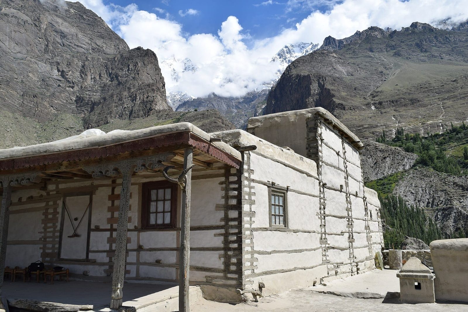
- Age: Altit Fort and its Shikari tower are around 1,100 years old — the oldest monument in Gilgit-Baltistan. Baltit Fort’s foundation is usually dated to about the 8th century CE, with major rebuilding later.
- Restoration: Baltit was restored by the Aga Khan Trust for Culture between 1990 and 1996; Altit was restored with support from the Government of Norway and reopened to visitors in 2007, winning the UNESCO Asia-Pacific Award of Distinction in 2011.
- Time needed: one full day on foot for both forts plus the old village lanes; two days if you want the valley at a walking pace.
- Season: open year-round. April–May for blossom, June–September for warmth and clear roads, October for autumn colour, winter for cold, quiet and the sharpest mountain light.
Where the forts are, and why they matter
Hunza sits on the old road between the Indian subcontinent and Central Asia. Whoever held the valley held the traffic through it. For centuries that was the Mirs of Hunza, ruling a small state from a rock above the river. Altit was the first seat. Roughly three centuries later the rulers moved up the hill to Baltit, and Altit was left to the village around it.
There is a Baltistan thread running through both buildings, which is why they interest us. In the 16th century a prince of Hunza married a princess from Baltistan, and she brought Balti master craftsmen with her. Those craftsmen worked on both forts. If you have already seen Shigar Fort or Khaplu Palace down in our own valleys, you will recognise the timber-and-stone logic immediately. Look for the cribbage walls, the low doorways, the flat earth roofs and the carved wooden columns. Same building tradition, different kingdom.
Both forts were close to lost. Baltit was abandoned by the Mirs in 1945 for a new house lower down and simply decayed for four decades. A survey by the Royal Geographical Society in London helped trigger a rescue. The Aga Khan Trust for Culture’s Historic Cities Support Programme then ran the restoration from 1990 to 1996. Altit was in worse condition and had to wait until the early 2000s. Today Baltit is a museum run by the Baltit Heritage Trust, and Baltit Fort has been on UNESCO’s World Heritage Tentative List since 2004.
Altit Fort: the older one, on the rock
Start here, not at Baltit. Altit is the older building and the smaller one, and seeing it first makes sense of everything you then see up the hill.
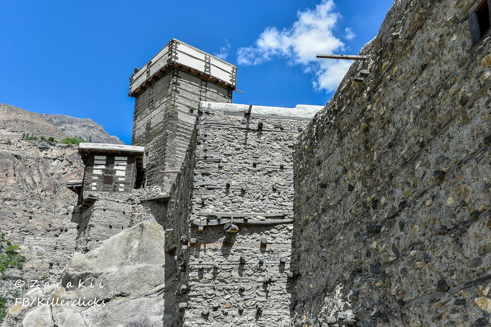
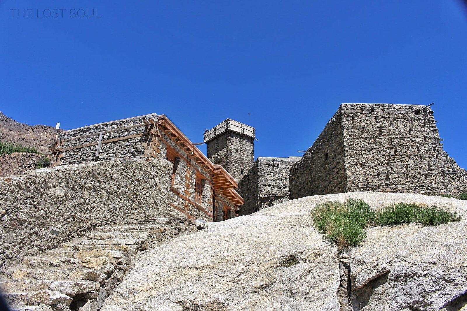
The fort is built onto a rock spur that drops straight to the Hunza river. The Shikari tower — watchtower and last redoubt — is the part dated to around 1,100 years old. Inside it is deliberately awkward. Small rooms, low portals you have to duck through, ladders rather than staircases, and dark passages with a single shaft of light. That is not poor design, it is defence. The wood carving around the doorways and columns is the thing to slow down for.
The name itself tells you something. “Altit” means roughly “this side down” in Burushaski, a language isolate spoken here and nowhere else. It is not related to Urdu, not to Balti, not to anything. The old settlement around the fort has been conserved alongside it. There is also a garden with a café where most visitors sit for half an hour afterwards. If you want the wider story of who lives in this valley, we wrote about it in the real story behind Hunza’s longevity myths.
Baltit Fort: the seat on the ridge
Baltit is the picture you have already seen: a white-and-timber block sitting on a shoulder of rock with the Ultar massif directly behind it. It is bigger than Altit and better lit. The restoration gives you a clear route through royal quarters, kitchens, storerooms, a throne room and finally the roof.
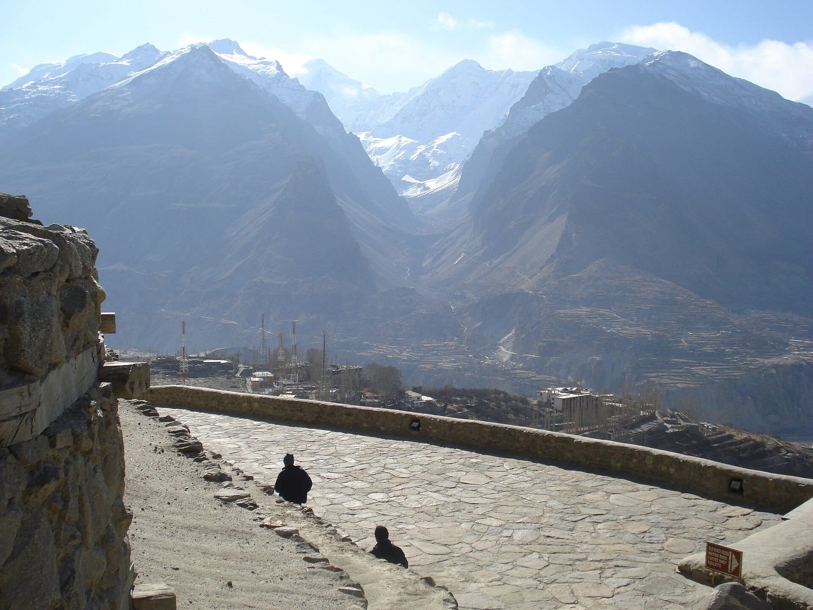
What holds people longest is not the architecture but the balconies. Standing there you are looking down the full width of the Hunza valley, terraced field by terraced field. Rakaposhi stands opposite, with Ultar Sar hanging over your shoulder. The museum’s collection — old rifles, cooking gear, the small hard objects of a mountain court — is modest, and better for it.
A sensible day on foot, step by step
- Morning, Altit village. Walk the old lanes below the fort first, before the coaches arrive. Twenty minutes, no cost, and it sets the scene.
- Altit Fort, guided. Entry includes a local guide. Allow an hour to an hour and a quarter.
- The Altit garden and café. Half an hour. Apricot trees, and the first honest sit-down of the day.
- Walk Altit to Karimabad. Roughly 2–3 km uphill on lanes and a link path, 45 minutes to an hour at a steady pace. Take a taxi if the heat or the gradient is not for you — no shame in it.
- Baltit Fort, guided. An hour to ninety minutes, ending on the roof. Go late afternoon if you can: the light on Rakaposhi is better and the crowd has thinned.
- Karimabad bazaar, then the viewpoint. Finish in the bazaar below the fort, or push on up to the Duikar viewpoint above the valley for sunset if you have transport.
The view from the balconies: what you are actually looking at
People point at the wrong mountains constantly up here, so here is the honest list. From Karimabad you can see, on a clear day, some of the biggest peaks in the western Karakoram. These are the summits, not viewpoints you can reach.
Ultar Sar (7,388 m) is the one hanging over Baltit Fort, and its glacier feeds the channel that has watered Karimabad’s terraces for centuries. Bublimotin, the rock spire everyone calls Ladyfinger, is the sharp tooth on the same ridge. If the meadow below Ultar tempts you, that is a real trek and we cover it in the Ultar Meadow and Hon Pass guide. Across the valley, Rakaposhi at 7,788 m rises from around 2,000 m at the river — one of the great uninterrupted mountain walls anywhere.
When to go
Unlike almost everything else we run, this one has no closed season. The forts are buildings, not passes. What changes is the road, the light and the crowd.
| Months | Conditions | Verdict |
|---|---|---|
| March–May | Apricot and cherry blossom through the valley, cool mornings, occasional rain and rockfall closures on the KKH. | The prettiest window. Book early — blossom season fills up. |
| June–August | Warm and dry, all roads and side valleys open, the busiest domestic tourist period. | Best if you are combining the forts with trekking. Expect company at the fort gates. |
| September–October | Clear air, golden poplars, cold nights, thinning crowds. | Our pick. The mountain views are at their sharpest. |
| November–February | Cold, very quiet, snow on the peaks; road travel possible but weather-dependent and some services shut. | Good for photographers and the patient. Not for a tight schedule. |
If you are pinning down dates across the whole region rather than just Hunza, our best time to visit Gilgit-Baltistan guide compares the valleys month by month, and the Hunza blossom guide covers the spring window in detail.
How hard is it, honestly
Easy — with two caveats we would rather tell you now than have you discover at the gate.
First, both forts are full of stairs, ladders and low doorways, and they were built to defend, not to accommodate. There is no lift and no step-free route. If you have knee trouble or limited mobility, Baltit is manageable at a slow pace with a hand, and Altit is harder. Second, at 2,440 m you are high enough to feel dry air, strong sun and cool evenings, though not high enough for altitude sickness. Drink more than you think you need. That said, most people fly or drive into Hunza from far lower ground, and if Hunza is the start of a bigger mountain trip you should read our acclimatisation guide before you go higher.
The road, not the forts
The real risk here is the road, not the forts. The Karakoram Highway between Gilgit and Hunza runs under active rockfall slopes and is periodically closed by landslides, and river-crossing bridges and side tracks can be damaged after heavy melt or rain. That is a scheduling risk and occasionally a safety one. We drive it with experienced local drivers, in daylight, and we build a buffer day into every itinerary that depends on it. On our high-mountain trips we carry a satellite phone and work to an evacuation plan with established helicopter-rescue contacts — and we hold the same standard on road trips, because a valley with a blocked highway is still a valley you have to get out of.
Permits and visa. Hunza and Karimabad are open zone. You do not need a trekking permit or a mountaineering permit to visit Baltit Fort or Altit Fort — you simply pay the entrance fee at each. Both forts charge admission, with a lower rate for local residents, and the fee includes a guide at Altit; rates change, so confirm on the day rather than budgeting from a blog. What you do need is the right Pakistan visa, and if your trip continues into a trek or an expedition that is a different visa category, not the tourist one. We set out the categories, the Letter of Invitation, and the common mistakes in our Pakistan visa guide for trekkers.
Getting there, and what it costs
Karimabad is about 100 km north of Gilgit on the Karakoram Highway, roughly two to three hours by car depending on road conditions. Gilgit has flights from Islamabad, and Skardu — where we are based — is connected to Hunza by road via Gilgit, a long but spectacular day. Coming overland the whole way from Islamabad is two days with an overnight stop, and it is a proper journey in itself; our Karakoram Highway road-trip guide covers the stages. If you are still deciding which half of Gilgit-Baltistan to give your time to, read Hunza vs Skardu first — it will save you a wasted day.
Most people combine the forts with the upper valley: Attabad, Gulmit, and the Passu area, which we cover in the Passu Cones and Batura Glacier guide. Two nights in Karimabad and one further up is a comfortable shape for a first visit.
On cost
On cost: we keep pricing personal rather than posting a number that goes stale the week after we publish it. A fort day is a small part of a trip budget — transport, driver, accommodation and your guide are what move the figure, and they depend on your dates, group size and whether Hunza is a standalone trip or a leg of something bigger. Tell us the shape of your trip and we will quote it properly. Fair price, no corners cut on the people or the vehicle.
Seven hundred years of the valley, one afternoon. Our 7-day Hunza Valley Tour Package spends a full Karimabad day at Baltit and Altit with sunset from Duikar, from $860 per person — or go deeper on the 6-day Hunza Cultural Tour from $800.
See both forts in one day. Our Baltit & Altit Forts Heritage Day Tour covers Baltit, the old Karimabad lanes and Altit’s 1,100-year-old Shikari tower with a local guide and both fort tickets included, from $65 per person.
Frequently asked questions
How old are Baltit Fort and Altit Fort?
Altit Fort, and in particular its Shikari tower, is around 1,100 years old, which makes it the oldest standing monument in Gilgit-Baltistan. Baltit Fort’s foundation is generally dated to about the 8th century CE, but the building you walk through today is the result of centuries of rebuilding, including major 16th-century work by Balti craftsmen, and a full restoration completed in 1996.
If I only have time for one, which fort should I visit?
Baltit, for the views and the more complete museum route. But the two are only a few kilometres apart and Altit takes about an hour — if you have half a day, do both. Altit gives you the older, rawer building; Baltit gives you the balconies over the valley.
Are the forts open all year?
Yes. Both operate as museums year-round, though opening hours are shorter in winter and some cafés and hotels in Karimabad close in the coldest months. The limiting factor in winter is road access on the Karakoram Highway, not the forts themselves.
How long do I need to see both forts?
One unhurried day. Allow about an hour at Altit, an hour to ninety minutes at Baltit, 45 minutes to an hour to walk between them, and time for the old village lanes and the bazaar. Two days lets you add the Duikar viewpoint and a slower morning.
Do I need a guide, and is there an entrance fee?
Both forts charge an entrance fee, with a reduced rate for local residents, and admission at Altit includes a local guide as part of the ticket. Rates are set by the trusts that run the forts and change from time to time, so check on arrival. A guide is genuinely worth it here — without one the rooms are just rooms.
Plan your Hunza trip with a local team
We are a local Balti team based in Skardu, not a broker. Your trip is run by our own people and our own logistics, and in Hunza we work directly with Burusho guides from the valley rather than handing you to an agency. Tell us your dates and group size and we will build the itinerary around them.
WhatsApp us on +92 312 9921574 or email info@karakoramventure.com. Local hands, real safety, fair price.
Sources & attribution: fort history, dates, restoration and award details drawn from Wikipedia (Baltit Fort, Altit Fort, Karimabad, Ultar Sar, Rakaposhi), the UNESCO World Heritage Tentative List, and the Aga Khan Development Network’s published account of its conservation work in Gilgit-Baltistan. Elevations are approximate and rounded; entrance fees and road conditions change — confirm locally before travel. Photographs: Shaukatjaveed (CC BY-SA 4.0), Harismoghal (CC BY-SA 4.0), Ammarqureshi85 (CC BY-SA 3.0) and Fassifarooq (CC BY-SA 4.0), all via Wikimedia Commons.

