



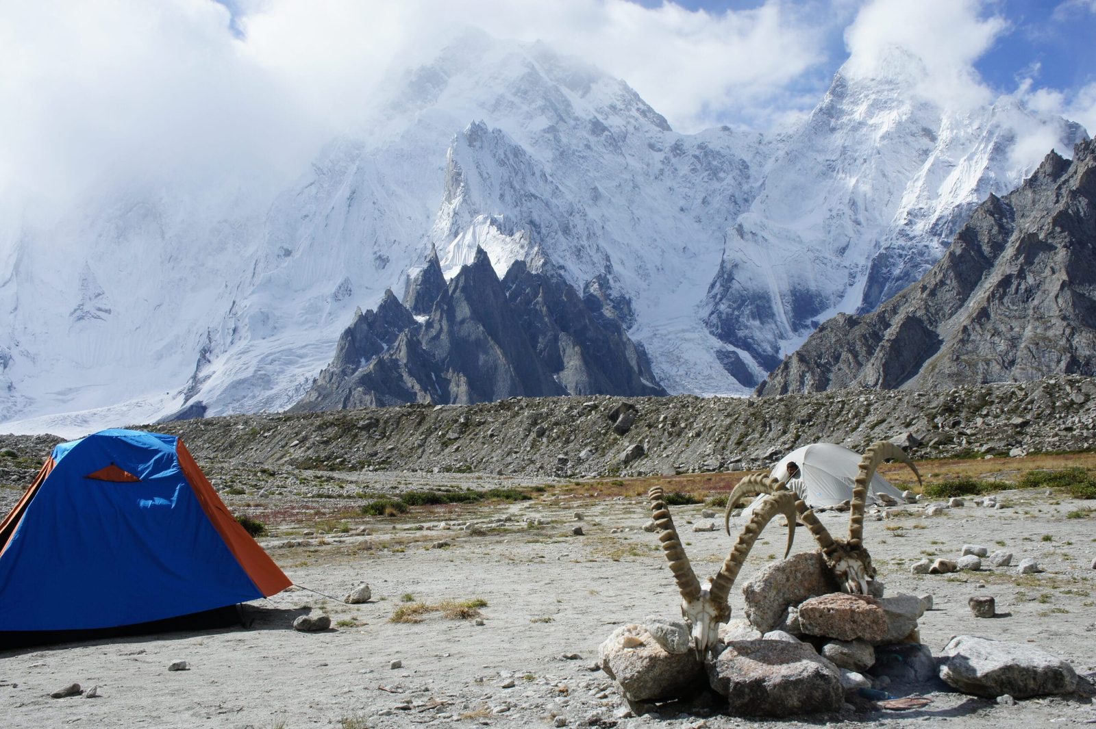
K6 — surveyed as K6 and known locally as Baltistan Peak — is a 7,282 m mountain in the Masherbrum Mountains of the Karakoram, the highest peak around the Charakusa Glacier at the head of Pakistan’s Hushe Valley. You reach its base camps on foot from Hushe village (about 3,050 m), a jeep drive of roughly 120 km and six to seven hours from Skardu. Allow eight to ten days for the round trip to the Charakusa and K6 base camps at roughly 4,100–4,600 m. The season runs June to September. The walk in is moderate; the mountain itself is serious, technical alpinism and has seen very few ascents.
We run this valley out of Skardu with our own Balti team — the same porters and cooks who have families in Hushe and Kanday. So we will be straight with you. Most people who say “K6” mean the trek to its base camps, and that is a fine, hard, beautiful walk. Climbing K6 itself is a different order of commitment: a big, steep, cold mountain that the record shows has turned back far more teams than it has let up. We will happily take you to either. We will not pretend they are the same trip.
Key takeaways
- Height: 7,282 m (23,891 ft), with a prominence of 1,962 m — high enough to rank as an ultra-prominent peak.
- Where: Masherbrum Mountains, Karakoram, Gilgit-Baltistan — at the head of the Charakusa Glacier above the Hushe Valley.
- Three summits: K6 Main (7,282 m), K6 Central (around 7,100 m) and K6 West (around 7,040 m) — all above 7,000 m.
- First ascent: 1970, by an Austrian team led by Eduard Koblmüller, via the south-east ridge from the Nangmah Glacier.
- Trek: 8–10 days round trip from Hushe to the Charakusa and K6 base camps, high point roughly 4,600 m.
- Season: June to September, with July and August the most settled.
Where K6 (Baltistan Peak) is, and why it matters
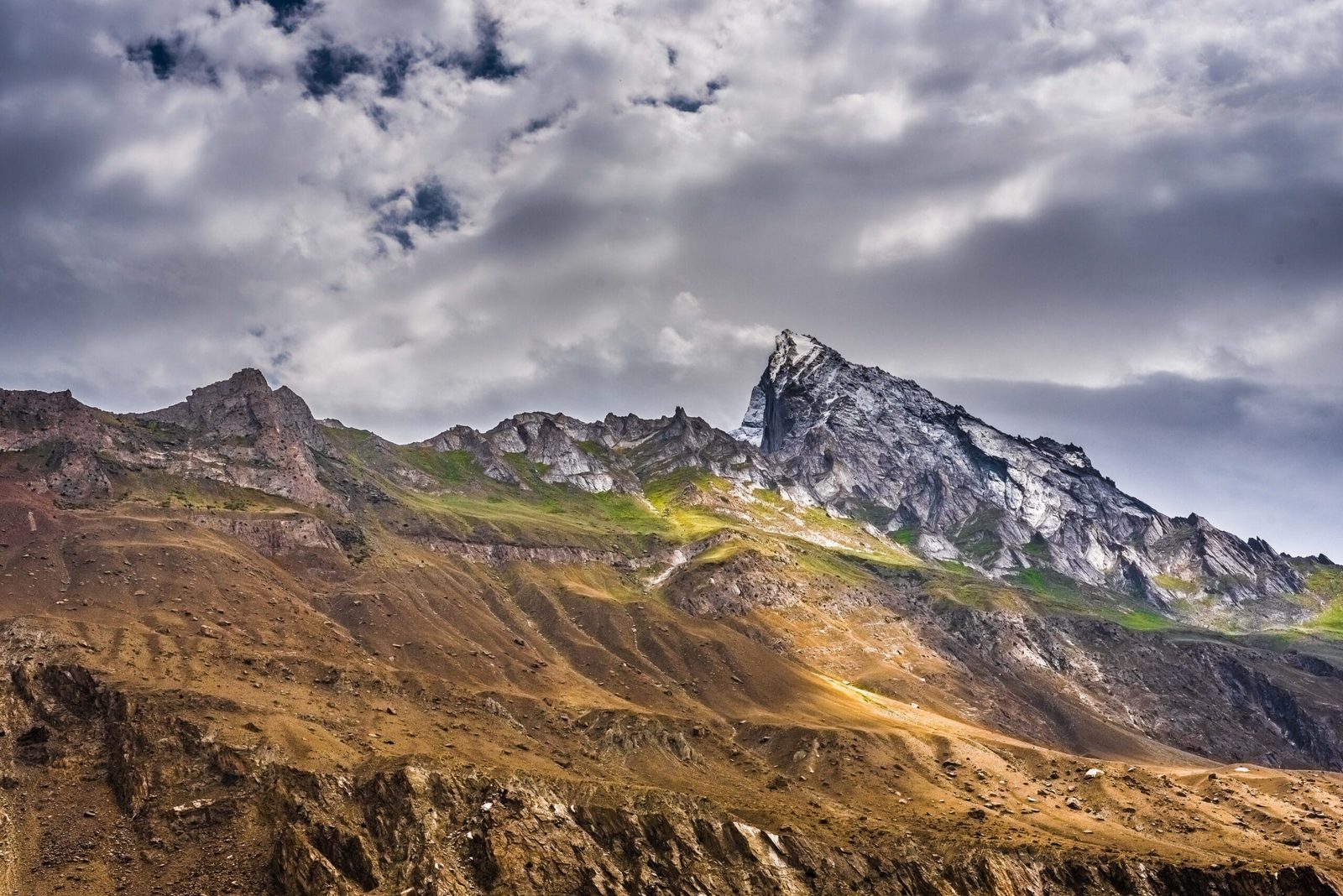
Drive east out of Skardu, follow the Shyok up past Khaplu, and turn south into the Hushe Valley. The road ends at Hushe village, around 3,050 m, the last settlement before the ice. From there three glacier valleys fan out. One leads north-west to the Gondogoro La and Concordia. One climbs to Masherbrum. The third — the Charakusa — runs east into a cirque of granite towers and snow peaks, and at its head stands K6.
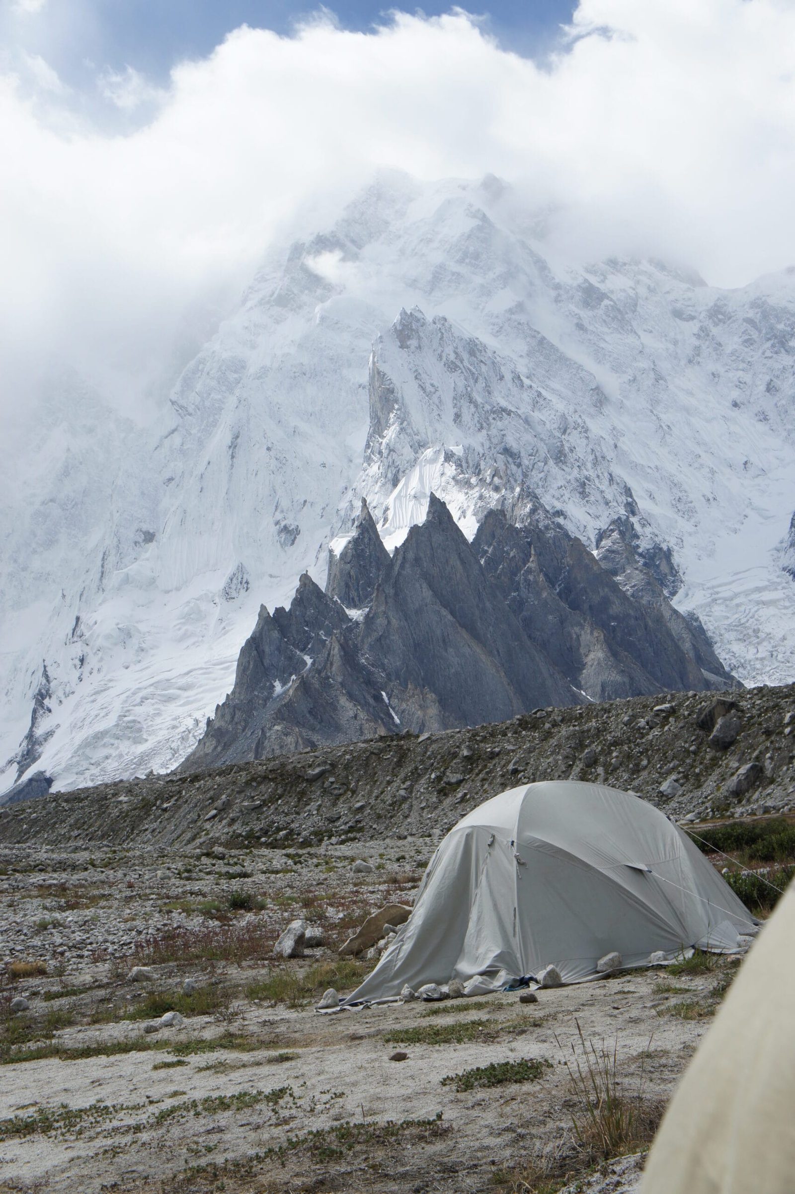
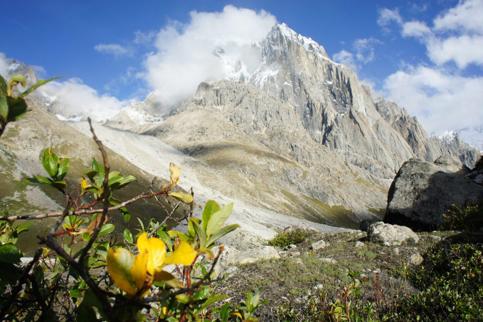
K6 is not an eight-thousander and does not pretend to be. What it has is relief. Wikipedia’s summary puts it plainly: despite being much lower than the neighbouring eight-thousanders and high 7,000ers, K6 has huge, steep faces and great relief above the valleys beneath it. Standing on the moraine at 4,100 m and looking up at three kilometres of rock and ice makes the number on the map feel small.
The Charakusa gives access to the north side of the mountain. To the south-west lies the smaller Nangmah Glacier — the line the first ascensionists used, and the same valley system that leads to the granite of Nangma Valley and Amin Brakk. East of the peak is the larger Kaberi Glacier. All of this water eventually runs into the Shyok, and then the Indus.
How Baltistan Peak compares to its neighbours
The route in, step by step
This is the standard base-camp itinerary we run. It is a trekking itinerary, not a climbing one — a climbing expedition adds several weeks of load-carrying, camp-building and waiting for weather on top of it.
- Skardu (about 2,230 m). Arrive, briefing, gear check, paperwork. If you flew in from Islamabad the same morning, take it slowly — see our how to get to Skardu guide.
- Skardu → Khaplu → Hushe (3,050 m). Roughly 120 km, six to seven hours by jeep along the Shyok. Worth breaking at Khaplu Palace if the timing works. Night in Hushe.
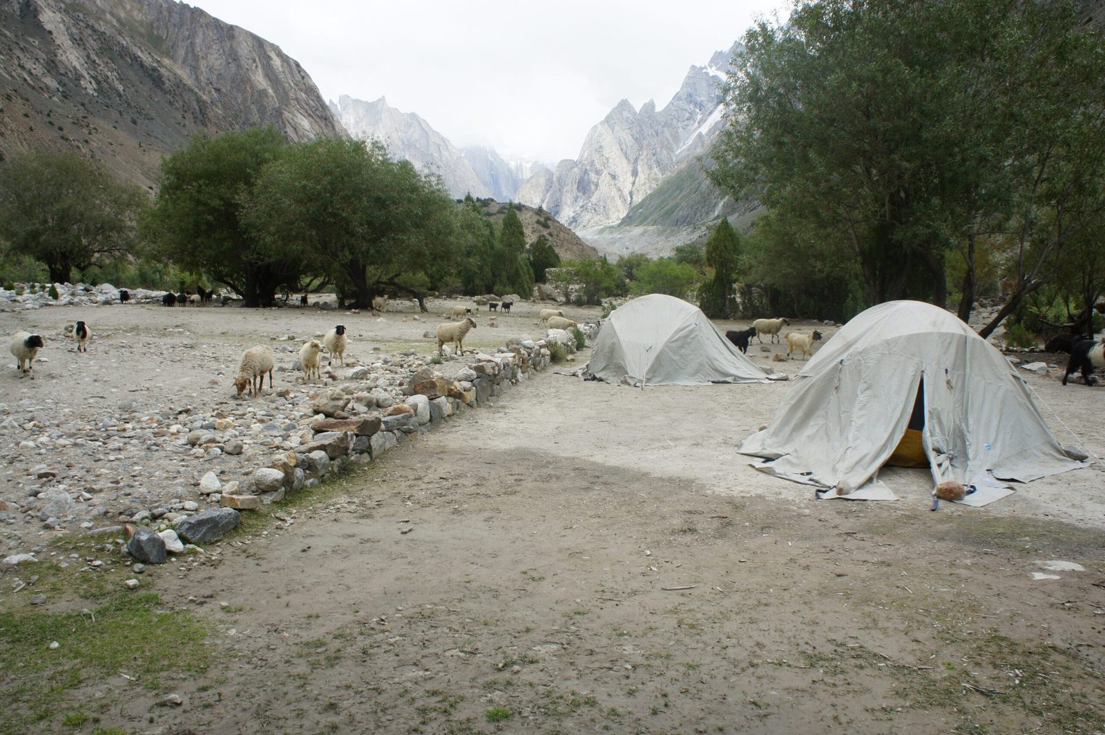
- Hushe → Saicho (about 3,350 m). Three to four hours on a good trail through willow and barley. Saicho sits at the junction of the Charakusa and the Gondogoro glacier valley.
- Saicho → Charakusa base camp (about 4,100 m). Five to six hours up moraine and meadow. The valley opens and the granite starts.
- Rest and acclimatisation day. Not optional. Short walk up, sleep low, drink more than you think you need. Read our acclimatisation guide before you come.
- Day walk to the K6 base-camp area (about 4,600 m). Loose moraine, a long day, and the payoff view of the face. Back down to sleep.
- Second high day. Moraine walk under K7 and the smaller spires, or a second rest day if the group needs it.
- Charakusa base camp → Saicho. Long descent, easier breathing.
- Saicho → Hushe → Khaplu. Walk out, jeep down.
- Khaplu → Skardu. Half a day on the road.
Eight days is possible if you are already acclimatised and the weather cooperates. Ten is more honest for most people, and it gives you a buffer day, which in this range is worth more than an extra summit view.
The profile: what you actually climb
The history: 1970, 2013, 2020
K6 was first climbed in 1970 by an Austrian expedition led by Eduard Koblmüller, with Gerhard Haberl, Christian von der Hecken and Gerd Pressl, by the south-east ridge from the Nangmah Glacier. There is a good story behind it: the team had come to Pakistan for a different mountain entirely — Malubiting — and the government withdrew that permission after they had already arrived. K6 was handed to them instead. They climbed it.
Then the mountain went quiet. The Himalayan Index records three further attempts on the main summit and no further ascents of it. That is the sentence to sit with if you are thinking of climbing here.
The subsidiary summits took longer still. K6 West, around 7,040 m, was called one of the last great problems in the Karakoram, and it turned back strong teams — Steve House, Vince Anderson and Marko Prezelj were forced off it by snowfall in 2007, in the same season they made the first ascent of K7 West. It was finally climbed in July 2013 by the Canadians Raphael Slawinski and Ian Welsted, alpine style up the north-west face over 25–30 July. That ascent won them a Piolet d’Or in 2014. K6 Central, around 7,100 m, held out until 2020, when Priti and Jeff Wright made its first ascent.
Next door, K7 (6,934 m) was first climbed on 8 August 1984 by a Japanese expedition led by Toichiro Nagata, by a two-month siege of the south-west ridge. The Charakusa has since become one of the best granite arenas in the range — see also Link Sar, whose own first ascent took decades of attempts.
When to go
| Months | Conditions | Verdict |
|---|---|---|
| November–March | Deep winter. The Hushe road is often blocked by snow; the glacier is bitterly cold and villages are shut in. | Closed for practical purposes |
| April–mid May | Snow still lies low in the valley. Cold nights, avalanche risk on the approach slopes, few porters available. | Ski and alpine teams only |
| Late May–June | Valley greening, glacier still firm, cold but often clear. Very quiet. | Good — expeditions start building camps |
| July–August | Warmest and most settled. Best summit windows; also the most meltwater and loosest moraine. | Best overall |
| September | Cold returns, air goes sharp and clear, autumn colour in Hushe. | Excellent for the base-camp trek |
| October | Hard night freeze, short days, porters heading down for winter. | Closing — early October only |
How hard is Baltistan Peak, honestly
The trek to base camp. Moderate to demanding. There is no technical climbing and no glacier crossing on the standard base-camp route, but there are long days of 5–7 hours on rough moraine, river crossings on the approach, and camps up to about 4,600 m. If you can walk uphill for six hours with a day pack, several days running, you will manage it. If you have never slept above 3,500 m, build the acclimatisation days in and do not skip them.
The mountain. Serious. K6 is steep on every side, objectively exposed, and its record — one ascent of the main summit in the Himalayan Index era, and decades of failure on the west and central summits — tells you what it asks. This is expedition alpinism for climbers with previous 6,000 m and 7,000 m experience, not a guided walk-up. If you want a first 7,000er, Chogolisa or Spantik is a far more sensible target and we will say so.
Cold and remoteness. Hushe is the last village. From Saicho upwards there is no shop, no clinic, no phone signal. Everything you need goes in on someone’s back. Get your kit right first — our Karakoram packing list is written for exactly this kind of trip.
Safety: the real risk here is that you are a long way from help
The dangers in Charakusa are altitude illness, rockfall on the moraine and loose ground below the faces, and the plain fact of distance: from K6 base camp, walking back to a road takes the better part of two days. We carry a satellite phone on every trip into this valley, we work with established helicopter-rescue contacts for the Karakoram, and we make you carry insurance that actually covers helicopter evacuation and high-altitude trekking — not the travel policy that came free with your credit card. Read our insurance guide and get this sorted before you fly. A plan you have not tested is not a plan.
Permits and visa
Trekking to the Charakusa and K6 base camps is normally handled as open-zone trekking — the same footing as the other Hushe valleys. Going above the base camps onto K6, K6 Central or K6 West is a mountaineering expedition and needs a peak permit and the associated official arrangements. Fees and requirements are set by the authorities and change from season to season, so we confirm the current rules for your specific objective before you commit — we would rather check than quote you a number that turns out to be last year’s.
On the visa: trekkers and climbers need a Trekking and Mountaineering visa, which is not the same as a plain tourist visa. Start it early. Our Pakistan visa guide for trekkers walks through it.
Getting there, and what it costs
Fly Islamabad to Skardu when the weather allows — it is about an hour, and the flight itself passes Nanga Parbat. When it does not allow, the road takes a long day or two and you should budget buffer days either way. From Skardu it is jeep to Hushe, then your own legs.
On price: we keep pricing personal rather than posting a number that goes stale, because what this trip costs depends on your group size, how many days you want, whether you are trekking to base camp or mounting a climbing expedition, and what the permit position is that season. Tell us the dates and the objective and we will put a real figure in front of you. What we will promise is a fair price with no corners cut — the guides, the food, the sat phone and the insurance requirement do not get trimmed to win a booking. Local hands, real safety, fair price.
If Charakusa is on your list, it pairs naturally with the other Hushe objectives: Masherbrum base camp, Laila Peak, or a crossing of the Gondogoro La to come out at Concordia.
Frequently asked questions
How high is K6 (Baltistan Peak)?
K6 is 7,282 m (23,891 ft), with a prominence of 1,962 m, which makes it an ultra-prominent peak. Two subsidiary summits, K6 Central (around 7,100 m) and K6 West (around 7,040 m), also stand above 7,000 m. Figures for the two subsidiary summits vary a little between sources.
Who first climbed K6, and when?
An Austrian expedition led by Eduard Koblmüller, with Gerhard Haberl, Christian von der Hecken and Gerd Pressl, made the first ascent in 1970 by the south-east ridge from the Nangmah Glacier. The team had originally been given permission for Malubiting; that was withdrawn after they arrived in Pakistan, and K6 was allotted to them instead. K6 West was first climbed in July 2013 by Raphael Slawinski and Ian Welsted, and K6 Central in 2020 by Priti and Jeff Wright.
How long does the trek to K6 base camp take?
Plan on eight to ten days for the round trip from Hushe, including acclimatisation and a buffer day. Charakusa base camp sits at roughly 4,100 m and the K6 base-camp area at roughly 4,600 m. Add the Skardu–Hushe jeep drive of six to seven hours at each end.
Do I need mountaineering experience to trek to Charakusa?
No. The base-camp trek involves no technical climbing or glacier travel on the standard route — it is long days on rough moraine at altitude. You do need decent hill fitness and a sensible acclimatisation plan. Climbing K6 itself is an entirely different proposition and requires substantial prior 6,000 m and 7,000 m experience.
When is the best time to go to the Charakusa Valley?
June to September. July and August give the most settled weather and the best summit windows for climbers; September is often the finest month for the base-camp trek, with sharp clear air and autumn colour in Hushe. Outside that window the Hushe road and the valley are effectively closed by snow.
Plan your Charakusa trip with a Balti team
Tell us your dates, your group size and whether you are heading for base camp or for the mountain, and we will come back with a real itinerary and a real number. You will be dealing with the people who actually run the trip — our own Balti guides, cooks and porters from these valleys, not a broker passing you down the line.
WhatsApp: +92 312 9921574 · Email: info@karakoramventure.com
Sources & attribution: elevation, prominence, first-ascent and geography details from Wikipedia’s K6 (mountain) article and the American Alpine Journal / Alpine Journal reports of the 1970 Austrian expedition; K6 West 2013 and K6 Central 2020 first-ascent details from PlanetMountain and Alpinist; K7 first-ascent details from American Alpine Club publications. Figures for K6 Central and K6 West are approximate and vary between sources. Images: K6, K6 base camp, Saicho campsite and K7 by Cooolvirus (CC BY-SA 3.0); Hushe Valley by Moiz Ismaili (CC BY-SA 4.0) — all via Wikimedia Commons.

