



K7 is a 6,934 m granite and ice peak at the head of the Charakusa Glacier, above the Hushe Valley in Ghanche district, Gilgit-Baltistan. It was first climbed on 8 August 1984 by a Japanese expedition led by Toichiro Nagata, siege-style up the south-west ridge. Base camp sits at roughly 4,360 m and is reached on foot from Hushe village (about 3,050 m), itself a six to seven hour jeep drive from Skardu. Allow eight to ten days for the base-camp trek; a climbing expedition needs four to six weeks. The season is June to September. The walk in is moderate. The mountain is world-class hard.
We run the Charakusa out of Skardu with our own Balti team — porters and cooks whose families live in Hushe and Kanday, an hour below the trailhead. So we will be straight with you. K7 is one of the finest objectives in the Karakoram and one of the least forgiving; in more than forty years it has seen only a handful of ascents. If you want to stand underneath it, we will get you to base camp and it will be one of the best weeks you have had. If you want to climb it, bring a climbing CV and we will have a proper conversation about what that takes.
Key takeaways
- Height: 6,934 m (22,749 ft), at the head of the Charakusa Glacier.
- Where: Masherbrum Mountains, Karakoram — Hushe Valley, Ghanche district, Gilgit-Baltistan.
- First ascent: 8 August 1984, a Japanese expedition led by Toichiro Nagata, by the south-west ridge, after a two-month siege.
- Landmark ascent: Steve House soloed a new route on the south face on 24–25 July 2004, base camp to base camp in 41 hours 45 minutes — only the mountain’s second ascent.
- Base camp: around 4,360 m in the Charakusa; three to four walking days above Hushe.
- Season: June to September, with July and August giving the best climbing windows.
- Still unclimbed: K7 Central, the middle summit of the massif, has never been reached.
Where K7 stands, and why climbers keep coming back
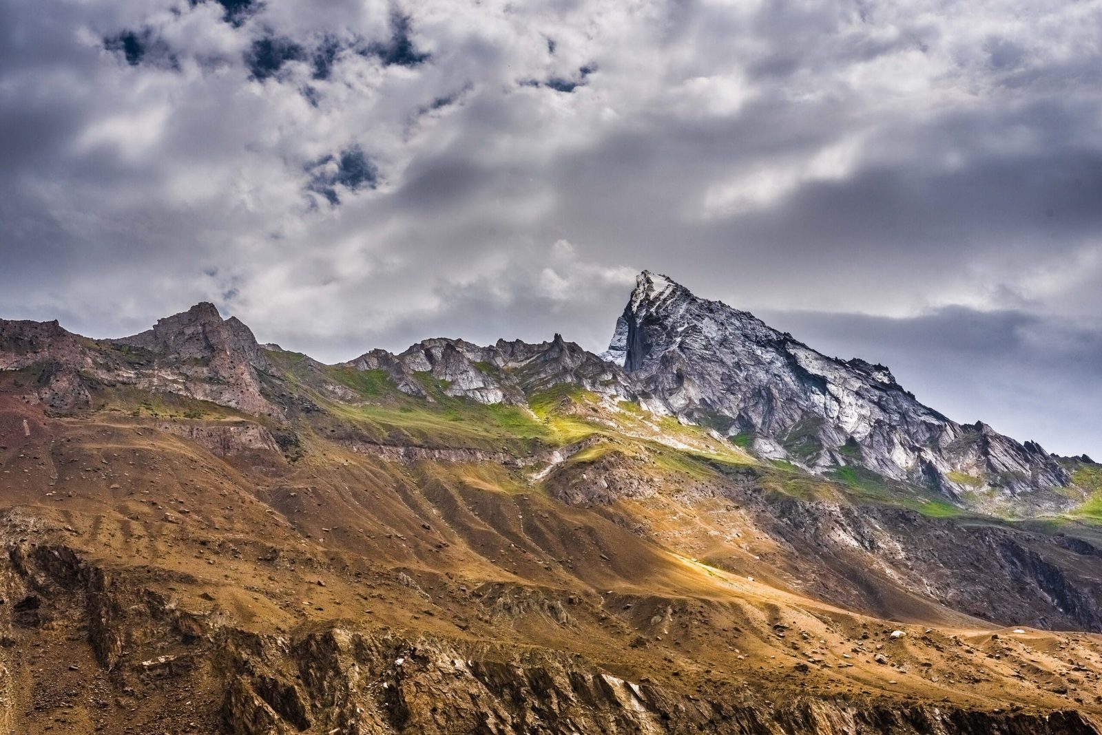
Walk south from the Shyok at Khaplu and the road turns up the Hushe Valley, past Machulo and Kanday, until it runs out at Hushe village under the south face of Masherbrum. From there a footpath climbs east into the Charakusa, a side valley of clean granite walls, meltwater braids and grass shelves. At its head, ringed by ice, stands K7.
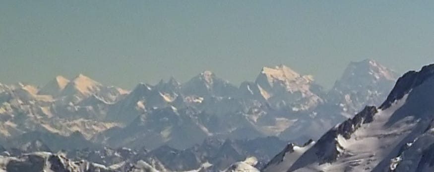
The name is a survey label, the same nineteenth-century Karakoram numbering that gave us K1 (Masherbrum) and K2. K7 kept its number because nobody replaced it with a local one that stuck. What the number hides is the shape: a steep, tapering pyramid of golden granite capped with snow, flanked by K6 (Baltistan Peak) at 7,282 m and Link Sar at 7,041 m.
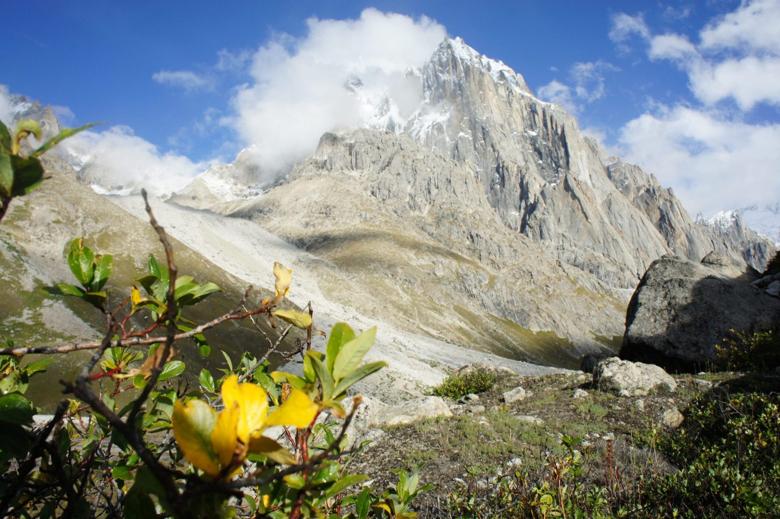
For alpinists, the Charakusa is one of the great small valleys on earth: base camp on grass, big walls within a morning’s walk, and three 7,000 m-class objectives visible from the cook tent. For trekkers, it is the reason to come to the Charakusa rather than the busier Baltoro — the same scale of mountain, a fraction of the traffic.
The peaks of the Charakusa and Hushe cirque
The walk in, step by step
This is the base-camp itinerary we run. It is a trekking itinerary, not a climbing one — an expedition to the summit adds several weeks of load-carrying, camp-building and sitting out weather on top of it.
- Skardu (about 2,230 m). Arrive, briefing, gear check, paperwork. If you flew in from Islamabad that morning, take the day slowly — see our how to get to Skardu guide.
- Skardu → Khaplu → Hushe (about 3,050 m). Roughly 120 km and six to seven hours by jeep along the Shyok, through Khaplu, Machulo and Kanday. Worth an hour at Khaplu Palace on the way.
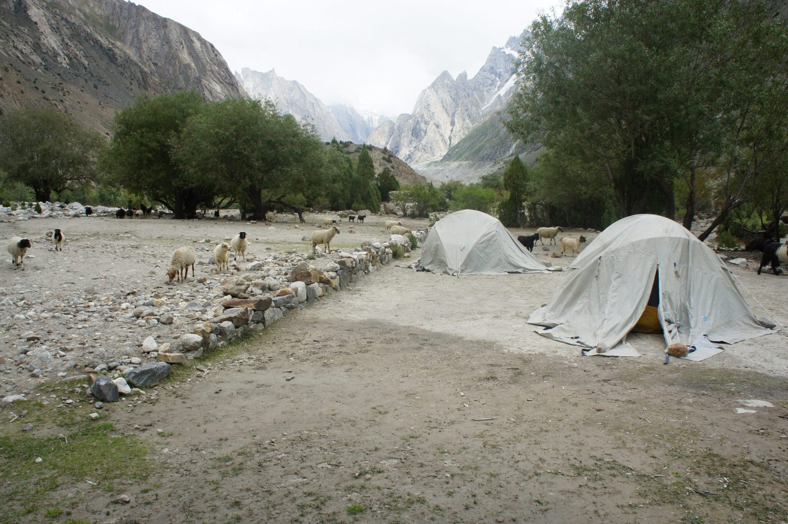
- Hushe → Saicho (about 3,400 m). An easy half-day up the valley floor to the campsite where the Charakusa branches off from the Gondogoro side. Good first night out.
- Saicho → Spangsar (about 3,850 m). Into the Charakusa proper. Steeper walking on moraine and grass, with the granite spires opening up ahead.
- Spangsar → Charakusa base camp (about 4,360 m). A long day onto the glacier shelf. K7 fills the head of the valley from here; K6 and Link Sar close the sides.
- Rest and explore day. Walk up towards the moraine viewpoints below K7 and the ground the climbing teams use. This is the day people remember.
- Return to Hushe over two days, then the jeep back to Skardu.
Eight to ten days door to door from Skardu is realistic, including one weather buffer. Do not cut the buffer. The Hushe road is a mountain jeep road and it does close.
The climb up, in profile
A short climbing history — and the summit nobody has reached
K7 turned back expedition after expedition before it fell. In 1984 a Japanese team under Toichiro Nagata put base camp on the Charakusa Glacier on 19 June and ground out the south-west ridge over two months, fixing some 6,500 m of rope and placing around 450 bolts and pitons. Camps went in at 5,190 m, 5,680 m, 6,020 m, 6,220 m and finally 6,550 m on the shoulder. On 8 August Akira Kamizawa, Eizo Mitani and Kakoto Takenata reached the top; Nagata, Michiyuki Matsuda and Atsuro Chiba followed the next day.
Twenty years later the mountain was climbed in a completely different style. Steve House, after two solo attempts the previous season, left base camp at five in the evening on 24 July 2004, soloed a new 2,400 m line on the south face, and was back in camp 41 hours 45 minutes later. It was the second ascent of K7. It remains one of the most respected solo climbs done in the Karakoram.
In September 2007 Marko Prezelj, Steve House and Vince Anderson made the first ascent of K7 West by its south-east face, roughly 2,000 m of climbing over four days. And the middle summit — K7 Central — is still untouched. Priti and Jeff Wright reached within about 100 m of it in 2022 after a huge new line on virgin ground, then returned in 2023 and got as far as the col at 6,536 m before the face iced up and sent them down. As of the most recent reporting, nobody has stood on top of K7 Central.
When to go
| Months | Conditions | Verdict |
|---|---|---|
| April – May | Snow still low in the valley; the Hushe jeep road can be blocked or rough; cold camps. | Too early for base camp. |
| June | Valley opening up, meltwater high, river crossings pushy. Expeditions start moving in. | Workable, with a guide who knows the crossings. |
| July – August | Warmest and most settled. Best summit windows; base camp busiest with climbing teams. | Best for climbing. |
| September | Cooler, clearer, low water, autumn colour in Hushe. Quietest camps. | Best for the trek. |
| October – March | Snow closes the valley and the road; villages settle in for winter. | Closed. |
If you are deciding between valleys and seasons more broadly, our best time to visit Gilgit-Baltistan guide lays out the whole year.
How hard is it, honestly
The base-camp trek: moderate to hard, but not technical. On the standard route there is no roped glacier travel and no climbing. What there is: four to six hours of walking a day, rough moraine, a couple of meltwater crossings that are serious in June and July, and a sleeping altitude of about 4,360 m. If you can walk hilly ground for six hours carrying a daypack, on consecutive days, you can do this. Read our acclimatisation guide before you book anything.
The mountain: expert only. K7 is steep mixed ground and hard granite at altitude, a long way from help, with very few ascents on record. This is not a peak you attempt as a first 6,000er. Teams that succeed here have already climbed technical alpine routes on big mountains. If Laila Peak or a 6,000 m trekking peak is your level right now, say so — that is a good conversation, not an awkward one, and there is plenty in this valley at that grade.
Rock climbers should also look at the Nangma Valley above Kanday, an hour back down the road — big walls, lower altitude, shorter approach.
Safety: this valley is remote, and it is not close to a hospital
The real risks in the Charakusa are altitude illness at base camp, glacial river crossings during the melt, rockfall on the moraine, and the simple fact that you are three walking days plus a seven-hour jeep drive from the nearest hospital in Skardu. There is no reliable mobile signal above Hushe. We carry a satellite phone on every trip into this valley, we run established helicopter-rescue contacts for Gilgit-Baltistan, and we require proof of insurance that covers helicopter evacuation at altitude — see our trekking insurance guide. Operators who skip these things are cheaper for a reason. We are not going to be that operator.
Permits and visa
Trekking to Charakusa base camp is normally handled as an open-zone trek, with local registration en route. Climbing K7 is a different matter: any peak of this height needs a mountaineering permit and royalty arranged in advance, along with a liaison officer, and the rules and fees are revised from time to time — we confirm the current position for your specific objective and dates before you commit to anything. On the visa side, trekkers and climbers should apply on the Trekking & Mountaineering visa rather than a plain tourist visa; our Pakistan visa guide for trekkers walks through it. We send the invitation and supporting documents you need.
Getting there, and what it costs
Fly Islamabad to Skardu when the weather allows — under an hour, and one of the great short flights anywhere. The road alternative up the Karakoram Highway and along the Indus takes two long days and needs buffer days built in, because Skardu flights are cancelled often enough that we plan for it. From Skardu it is one jeep day to Hushe.
On price, we keep it personal rather than posting a number that goes stale the moment permit fees, jeep rates or porter wages move. Tell us your dates, group size and whether you want the base-camp trek or a climbing expedition, and we will send a costed itinerary the same week. What we will promise is the thing our name rests on: a fair price with no corners cut on guides, food, porter welfare or the safety kit. Local hands, real safety, fair price.
Many people combine the Charakusa with the Gondogoro La crossing, since both start and end in this same valley. Ask us and we will map it out.
Frequently asked questions
How high is K7?
K7 is 6,934 m (22,749 ft), standing at the head of the Charakusa Glacier in the Masherbrum Mountains of the Karakoram. The massif has two subsidiary summits, K7 West and K7 Central, both close to 6,850–6,860 m; published figures for those two vary between sources.
Who first climbed K7, and when?
A Japanese expedition led by Toichiro Nagata made the first ascent on 8 August 1984 by the south-west ridge, siege-style over roughly two months. Akira Kamizawa, Eizo Mitani and Kakoto Takenata summited first, followed by Nagata, Michiyuki Matsuda and Atsuro Chiba the next day. The second ascent came twenty years later, when Steve House soloed a new route on the south face on 24–25 July 2004 in 41 hours 45 minutes round trip from base camp.
Can I trek to K7 base camp without climbing experience?
Yes. The trek to Charakusa base camp involves no technical climbing or roped glacier travel on the standard route. It does mean several consecutive days of four to six hours walking on rough moraine, glacial river crossings in early season, and sleeping at around 4,360 m. Good hill fitness and a sensible acclimatisation plan matter far more than climbing skill.
How long does the K7 base camp trek take?
Plan on eight to ten days from Skardu and back, including a rest day at base camp and one weather buffer. That covers the six to seven hour jeep drive to Hushe at each end and three to four walking days in each direction. A climbing expedition on K7 itself needs four to six weeks.
Has K7 Central been climbed?
No. As of the most recent reporting, K7 Central has never been summited. Priti and Jeff Wright came within roughly 100 m of the top in 2022 after climbing a major new route on previously unclimbed ground, and returned in 2023 to reach the col between K7 Central and K7 Main at 6,536 m before conditions turned them back. It remains one of the most sought-after unclimbed summits in the Karakoram.
Plan your Charakusa trip with a local Balti team
Send us your dates and group size and we will come back with a costed itinerary — base-camp trek or full expedition. We are a Skardu company with our own guides, cooks and porters from these valleys. Not a broker who hands you to someone else at the airport.
WhatsApp: +92 312 9921574 · Email: info@karakoramventure.com
Sources & attribution: K7 height, location and 1984 first-ascent details from American Alpine Club publications; Steve House’s 2004 solo and the 2007 first ascent of K7 West from American Alpine Club and Alpinist reports; K7 Central attempt details from ExplorersWeb reporting on Priti and Jeff Wright’s 2022 and 2023 expeditions; Hushe Valley geography from Wikipedia. Heights for K7 West and K7 Central are approximate and vary between sources. Images: aerial of Ghent Kangri, K7, Link Sar, K6 and Saltoro Kangri by Guilhem Vellut (CC BY 2.0); Hushe Valley by Moiz Ismaili (CC BY-SA 4.0); Saicho campsite and the head of the Charakusa Glacier by Cooolvirus (CC BY-SA 3.0) — all via Wikimedia Commons.

