



Attabad Lake lies in Gojal, Upper Hunza, about 14 km up the Hunza River from Karimabad, at roughly 2,500 m. It is not an old lake. It was made on 4 January 2010, when a landslide buried the village of Attabad, killed twenty people and dammed the river; by June that year the water ran some 21 km long and more than 100 m deep. Today the Karakoram Highway crosses above it through five tunnels, the drive up from Karimabad takes well under an hour, and you can stand on the shore in any month of the year. It asks nothing of your fitness.
We run our trips out of Skardu with our own Balti team, and we will be straight with you about two things. First, this is not our valley. Gojal is Wakhi country, the language on the shore is Wakhi, and the boatmen who know this water best live in Gulmit, Shishkat and Hussaini. When we bring clients here we work with them, and we say so. Second, the postcard version of Attabad leaves out the part that matters. This is a disaster site. Twenty people died here, and villages, orchards and a long stretch of the old Karakoram Highway lie under the water you are photographing. Go — it is one of the strangest and most beautiful places on the whole KKH — but go knowing what you are looking at.
Key takeaways
- Where: Gojal (Upper Hunza), Gilgit-Baltistan — about 14 km up the Karakoram Highway from Karimabad.
- Altitude: roughly 2,500 m. Published figures vary between about 2,400 m and 2,560 m, so treat it as approximate. Low enough that altitude sickness is not a concern.
- Born: 4 January 2010. A landslide buried Attabad village, killed twenty people and blocked the Hunza River for five months.
- Size: reached about 21 km long and over 100 m deep by June 2010. It is smaller now — the spillway was blasted lower in 2012.
- Access: year-round by road. Five tunnels, the Pakistan–China Friendship Tunnels, about 7 km in total, opened on 14 September 2015 on a rebuilt 24 km stretch of the KKH.
- Difficulty: none. This is a drive-and-boat destination, not a trek. No trekking permit, no fitness required.
Where Attabad Lake is, and why it is there at all
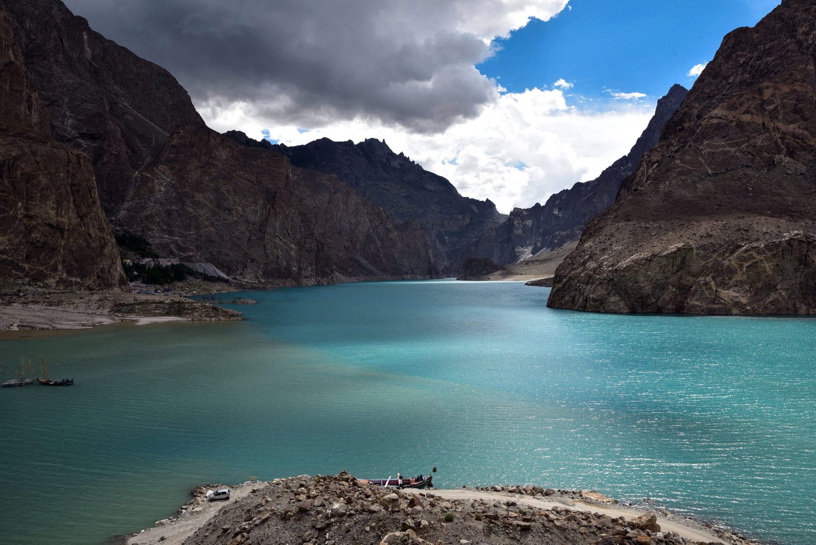
Attabad Lake — also written Ataabad, and sometimes called Gojal Lake or Hunza Lake — sits in the Hunza River valley in Gojal, the northernmost tehsil of Hunza District. Drive north from Karimabad on the Karakoram Highway and after about 14 km the river stops behaving like a river. It goes still, wide and an improbable turquoise, pinched between dry rock walls with no shoreline to speak of.
The reason is written on the mountainside. On one bank a huge bite is missing from the slope, and the debris from it crossed the valley floor and stopped the Hunza River dead. Everything upstream of that plug is the lake: Shishkat, then Gulmit — the main village and administrative centre of Gojal — then Hussaini and Passu beyond. This is the corridor you travel to reach the Passu Cones and the Batura Glacier, and further north the road to Khunjerab Pass and the Chinese border.
South of the lake is the Hunza most visitors picture: Karimabad, apricot terraces, and Baltit and Altit forts. Attabad is the hinge between that soft, cultivated valley and the harder, emptier country upstream.
4 January 2010: what actually happened
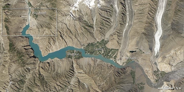
The slide came down on the morning of 4 January 2010 onto Attabad village, roughly 14 km upstream and east of Karimabad. Twenty people were killed. The debris dammed the Hunza River, and through the spring of 2010 the water rose behind it: around 6,000 people upstream were displaced, and as many as 25,000 were cut off as the road went under.
By the first week of June 2010 the lake had reached about 21 km in length and over 100 m in depth, and water began to spill over the landslide dam. Lower Shishkat was submerged completely, the hamlet of Ayeenabad disappeared, roughly 40 per cent of Gulmit was flooded, and land was lost at Hussaini and Ghulkin. More than 19 km of the Karakoram Highway went under water. In March and May 2012 the Frontier Works Organisation blasted the spillway and dropped the lake level by at least 10 m, which is why the water you see today is noticeably smaller than the lake in the 2010 photographs.
For five years after that, everything crossed by boat. Passengers, sacks of flour, cement, and cars winched onto flat barges. If a Gojali boatman shrugs at rough water today, that is the reason.
The road that came back: five tunnels and 24 km of new highway
On 14 September 2015 the realigned 24 km section of the Karakoram Highway around Attabad was opened. It carries five tunnels, known as the Pakistan–China Friendship Tunnels, roughly 7 km of tunnel in total, and was built at a reported cost of about $275 million. It put the Pakistan–China road link back together and ended the barge era overnight.
What that means for you is simple: an ordinary saloon car gets to Attabad Lake on tarmac, in comfort, all the way from Islamabad if you want it that way. The tunnels are unlit in places and the exits open straight onto the lake, so it is worth doing this stretch in daylight the first time.
Two days in Gojal: what you actually do
Attabad on its own is a two-hour stop. Gojal is a two-day trip, and that is how it is worth doing. Here is the route we run, from a base in Karimabad.
- Karimabad to the lake (30–40 minutes). Head north on the KKH. The best free viewpoints are the pull-offs above the water before you drop to the jetty — stop there first, while the light is still coming over the ridge.
- On the water (30–60 minutes). Boats run from the jetties near Attabad and Shishkat. Speedboats, larger cruisers, and jet-skis in the warm months. Ask for a life jacket before you agree a price, not after.
- Shishkat. The bridge and the shoreline here sit above what used to be the village and the old road. Worth ten quiet minutes.
- Gulmit (45 minutes on). Gojal’s main village: the old polo ground, carved wooden doors, a small local museum, and the climb to the Ondra Fort viewpoint if your legs want it.
- Hussaini and Passu. The Hussaini suspension bridge, then the Passu Cones — the serrated skyline every photograph of Hunza eventually borrows.
- Overnight in Gulmit or Passu. Small guesthouses, cold nights, very good apricots. Book ahead in July and August.
- Day two: north or back. Either run up to Sost and the Khunjerab Pass, or turn back down the valley towards Karimabad and the forts.
The giants above the water
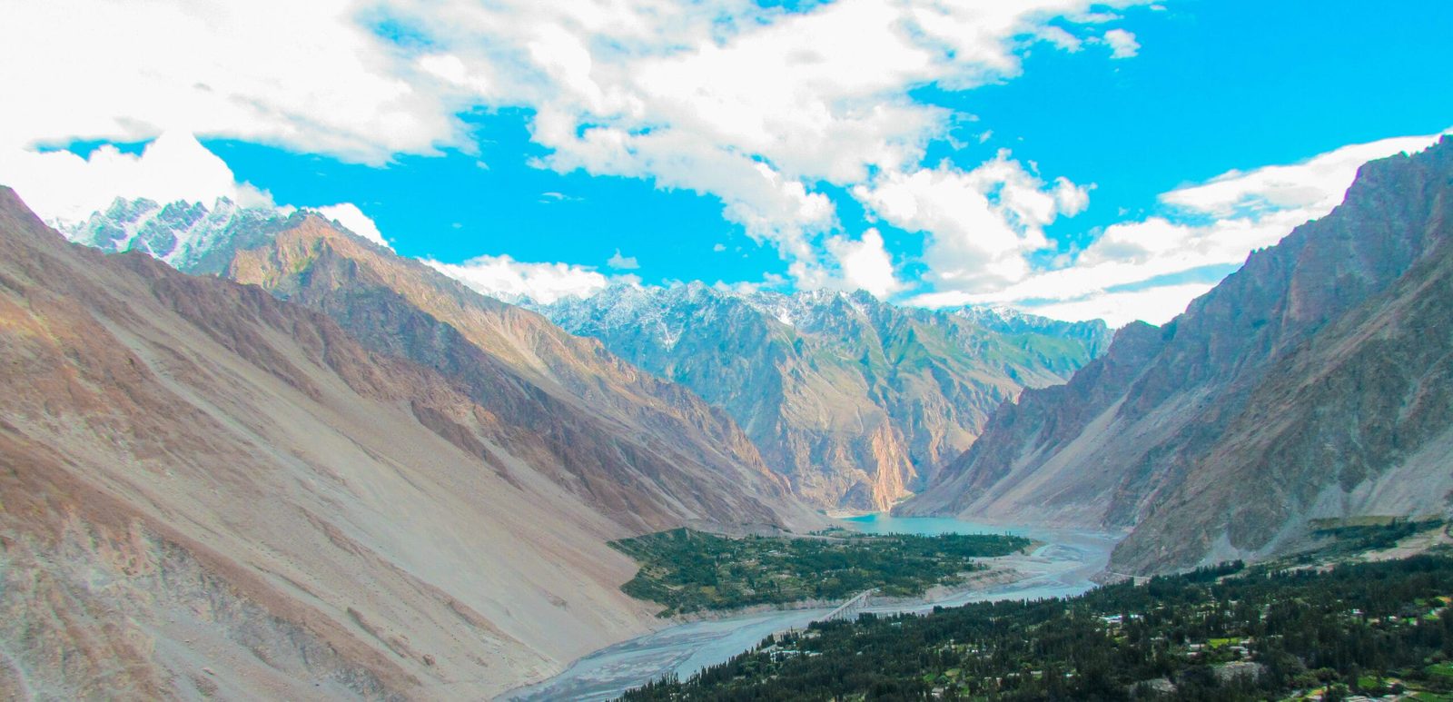
Here is an honest correction to most Attabad marketing: from the boat you do not see 7,000 m summits. The walls are too close and too high, and they hide everything behind them. What you get is rock, water and sky. The giants are there, though — you meet them a little further along the valley, or from the ridges above.
Shispare Sar (7,611 m) and Passu Sar (7,478 m) rise behind the Passu and Batura glaciers north of the lake. Ultar Sar (7,388 m) stands directly over Karimabad to the south, and Rakaposhi (7,788 m) dominates the drive up from Gilgit. If you want summits rather than water, that is the trip to plan.
When to go
Attabad is one of the few places in Gilgit-Baltistan that genuinely works in every season, because it is low and on a maintained highway. What changes is the light, the crowd and the risk of a road closure.
| Months | Conditions | Verdict |
|---|---|---|
| December–February | Cold and very clear. The KKH is usually kept open to Gojal but snow, ice and short closures happen. Winter sports events have been held on the lake in January. | Quiet and beautiful; travel is harder |
| March–May | Blossom through lower Hunza from late March, meltwater rising, few visitors. Cold mornings. | Excellent |
| June–August | Warmest and greenest. Khunjerab open, boats and jet-skis running, domestic holiday peak. Book accommodation ahead. | Good, but busy |
| September–October | Autumn colour, stable weather, the clearest views of the season. | Best all round |
| November | Colour gone, cold arriving, almost empty. | Fine if you want it to yourself |
If you are choosing between valleys rather than months, we have written both the seasonal guide to Gilgit-Baltistan and an honest Hunza versus Skardu comparison. For the blossom specifically, see the Hunza blossom guide.
How hard is it, and what actually goes wrong
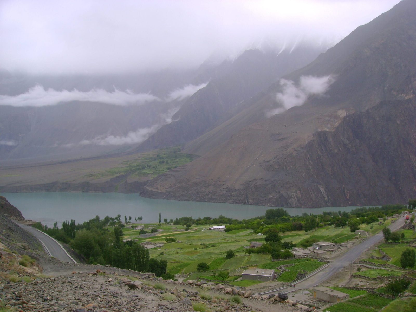
Physically, Attabad is the easiest thing in this guide. At roughly 2,500 m there is no altitude problem for a healthy visitor, the lake is reached on sealed road, and the only walking is from a car park to a jetty. Children and grandparents manage it fine.
The risks here are not mountain risks. They are road, water and weather risks, and they are real. The Karakoram Highway through Gojal runs under slopes that still shed rock; closures for landslides and snow happen, usually for hours, occasionally for days. The water is glacier-fed and cold enough to disable you quickly. Boats vary enormously in condition, and jet-skis on a busy summer afternoon are the most likely way to get hurt here. Mobile coverage is patchy the further north you go.
What actually goes wrong at Attabad
The honest risk: people do not get into trouble at Attabad from altitude. They get into trouble in cold water, in overloaded or poorly maintained boats, and on a highway that is still cut into an actively moving mountainside. Cold-water shock can incapacitate a strong swimmer within minutes.
How we handle it: we use boat operators we know personally and we do not put clients on a boat without a working life jacket each, whatever the season. Our vehicles carry a first-aid kit, and on any trip that leaves reliable phone coverage we carry a satellite phone and travel with a written evacuation plan — which hospital, which road, who we call. We build buffer time into Gojal itineraries so a road closure costs you an afternoon instead of your flight home. If conditions are wrong, we say so and change the day.
Permits and access: Attabad Lake is in an open zone. You do not need a trekking permit, a mountaineering permit or a No Objection Certificate to visit it, and there is no restricted-zone paperwork for the drive from Gilgit through Gojal to Sost. Entry fees apply if you continue into Khunjerab National Park, and separate rules apply the moment you switch from touring to trekking or climbing a peak.
Visa: every foreign visitor needs a Pakistan visa arranged before arrival. A tourist visa is enough for Attabad and the Gojal road; if the same trip includes trekking or an expedition, that is a different visa category. We set this out in detail in our Pakistan visa guide for trekkers.
Getting there, and what it costs
From Islamabad, you either fly to Gilgit and drive about three hours up the KKH to Karimabad, or you drive the full Karakoram Highway over two days with an overnight on the way. Flights are quick and weather-dependent; the road always works but eats time. From Karimabad it is 30 to 40 minutes to the lake. From Skardu it is a long single day via Gilgit, which is why we usually build Hunza and Baltistan as two halves of one trip rather than a day excursion. If safety in Pakistan is on your mind before you book, we have written about that honestly and without a sales pitch.
On price: we keep pricing personal rather than posting a number that goes stale the week fuel or permit costs move. Tell us your dates, your group size, whether you want a private vehicle or a seat in a shared one, and how many nights you want in Gojal, and we will quote the real figure. What we will not do is win the booking by cutting the driver’s rest, the vehicle’s condition or the safety kit. Fair price, no corners cut.
The lake is real and so is the boat. Our 7-day Hunza Valley Tour Package gives Attabad a full Gojal day with Gulmit, the Hussaini bridge and the Passu Cones, from $860 per person — the boat ride is included, and the Khunjerab day comes next.
Frequently asked questions
How was Attabad Lake formed?
By a landslide on 4 January 2010 that buried the village of Attabad in Gojal, Upper Hunza, killed twenty people and dammed the Hunza River. The river was blocked for five months and the water backed up to form the lake you see today.
How long and how deep is Attabad Lake?
At its maximum in June 2010 it reached about 21 km in length and over 100 m in depth. It is shorter and lower now: the Frontier Works Organisation blasted the spillway in 2012 and dropped the level by at least 10 m.
Can you visit Attabad Lake in winter?
Yes. The lake sits at roughly 2,500 m on the Karakoram Highway, which is normally kept open to Gojal through the winter, and winter sports events have been held on the lake in January. Expect cold, short days and the possibility of temporary snow closures, and build a buffer day into your plan.
Do you need a permit to visit Attabad Lake?
No. It is an open zone and needs no trekking permit or NOC. Foreign visitors need a Pakistan visa, and there is a separate entry fee if you continue north into Khunjerab National Park.
How far is Attabad Lake from Karimabad and Gilgit?
About 14 km from Karimabad, which is a drive of 30 to 40 minutes on the rebuilt Karakoram Highway through the five Attabad tunnels. From Gilgit, allow roughly three and a half hours in total.
Plan Gojal with a local team, not a broker
We are Karakoram Venture, based in Skardu, running Gilgit-Baltistan with our own Balti staff and long-standing Wakhi partners in Gojal. No third-party handover, no mystery subcontractor meeting you at the airport.
WhatsApp us on +92 312 9921574 or email info@karakoramventure.com with your dates and group size, and we will come back with a real itinerary and a real price.
Sources & attribution: formation, dimensions and damage figures from the Wikipedia entry on Attabad Lake and its cited reporting in Dawn and The Express Tribune; Karakoram Highway realignment details (24 km, five tunnels, roughly 7 km of tunnel, opened 14 September 2015, about $275 million) from the same sources. Lake altitude is given as approximate because published figures differ. Images: Abdullah Adnan Khan (CC BY-SA 4.0); NASA (public domain); Taseer Beyg (CC BY-SA 4.0); Gulsazam.sazam (CC BY-SA 3.0) — all via Wikimedia Commons.

